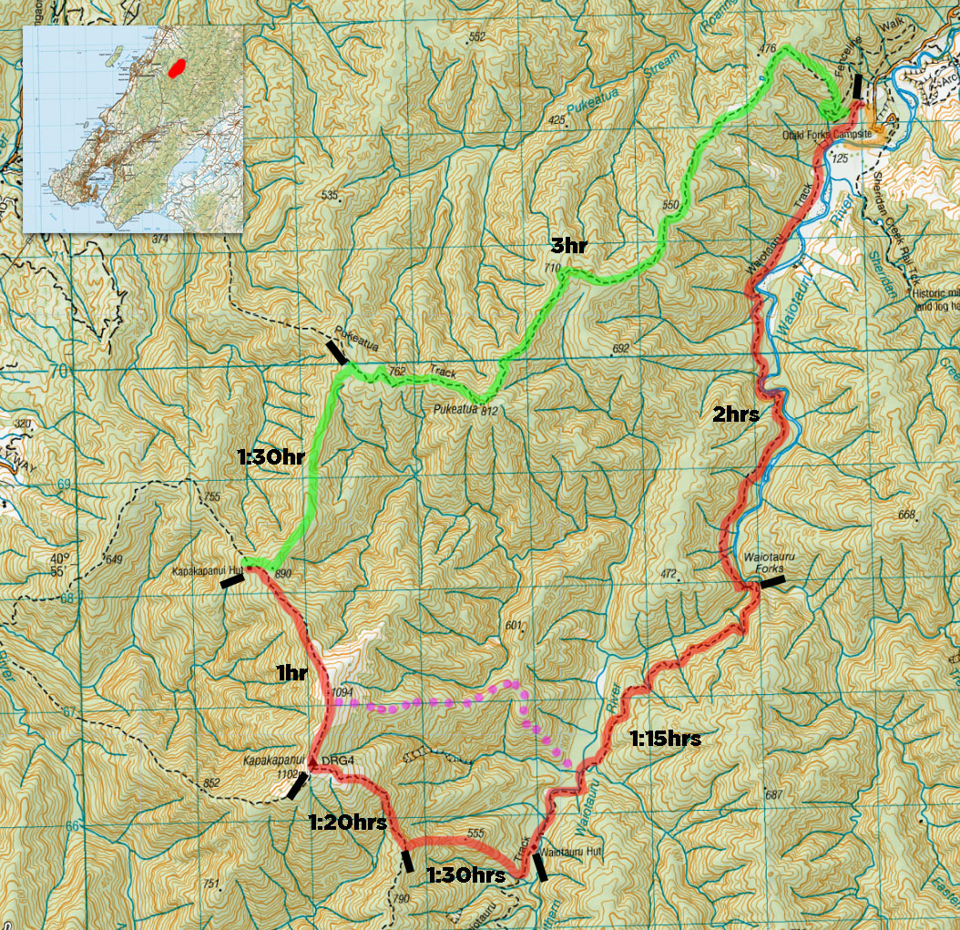
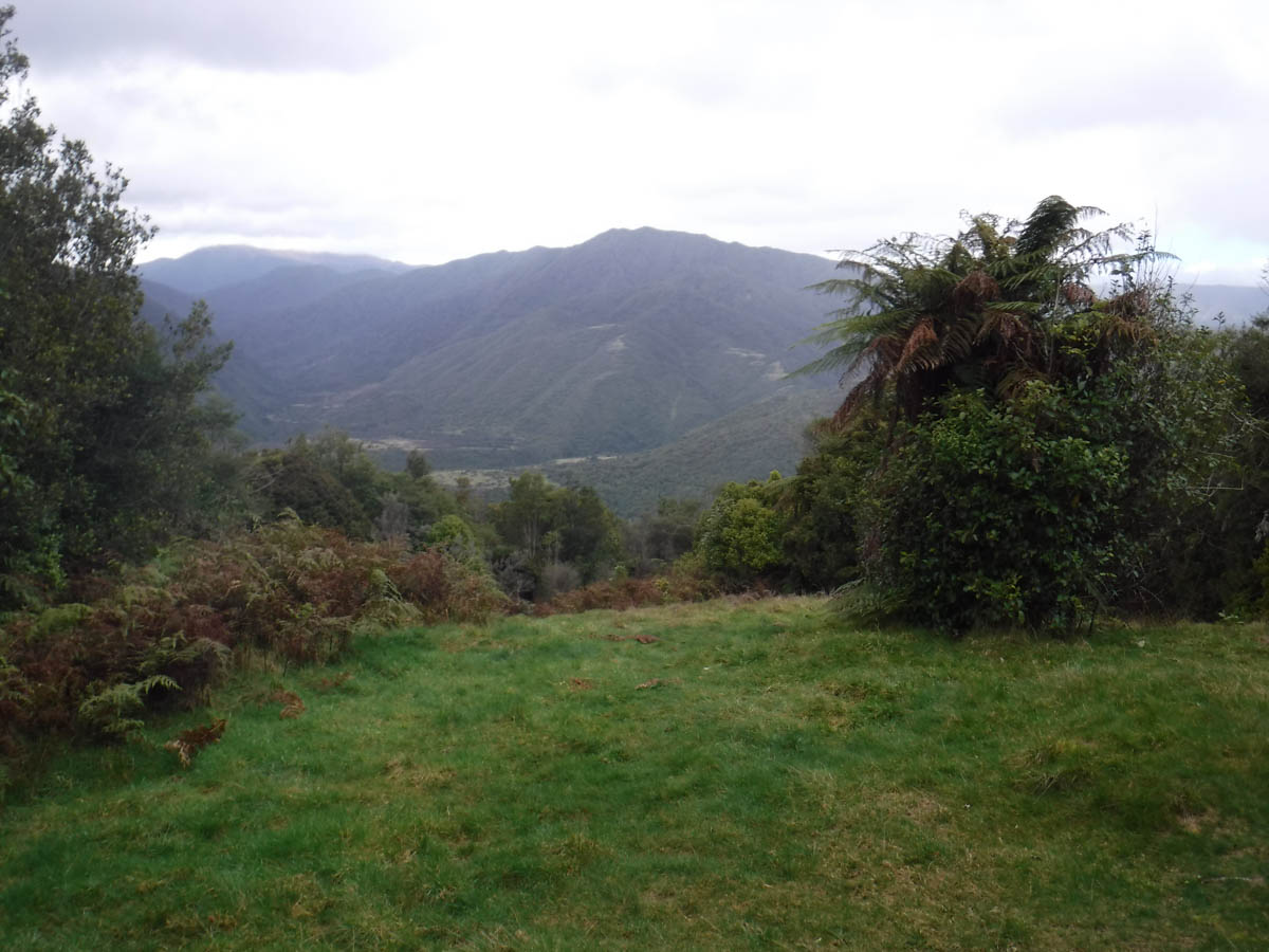
A impassable rock cliff drops to a deep pool at the end of the narrowing riverbank before us. Do we forge around, off-track and wet feet 10 minutes from the car, or back-track? This is my dilemma, facing the slippery riverbank of the Waiotauru River at the southern Otaki Forks campsite. We’re not ten minutes in and I’ve already fucked up the nav on my grandest off-track adventure to date.
We are a Meetup party of three dudes this weekend:
- M, the great bloke from my OTNZ course
- Y, less experienced but well up to the challenge
- and me.
Call it overconfidence, call it idiocy, the outcome is the same – I lead us down to the campsite and along the river. So blasé about a track starting from Otaki forks, I pay no heed to the notice board. I am strongly considering a river crossing, but M talks me down – we bush-bash back over to the car. Back at the noticeboard here, it is plainly obvious we head up and west, not just west.
I eat a lot of humble pie, self-flagellated, wasting 30 minutes of daylight. I am embarrassed, but M is a champion. ‘You were just testing us, to see if we had blind faith or not’. We go with that, the least crap justification we came up with, as we set off south-west along the western banks of the Waiotauru River. (nb. I have left this 30 minutes off our timings)
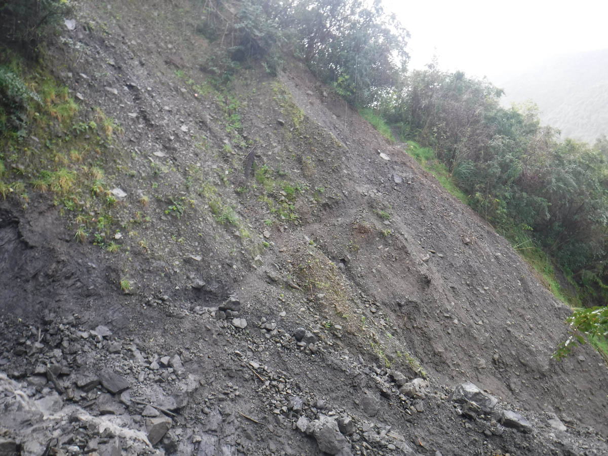
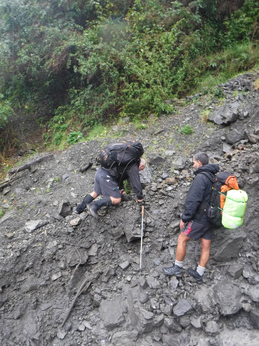
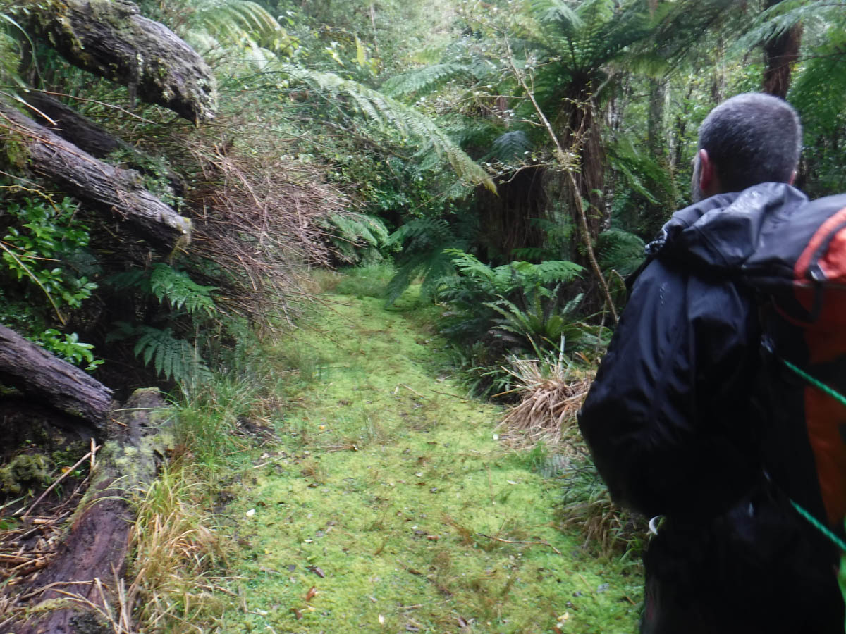
‘I need to see if the slip is bikeable for a mate’ says M – we quickly see it is not. The track skirts along the river bank, over numerous undercut slips. It’s pretty good on the whole, but the active slips could be a bit hairy – we set off some landslides.
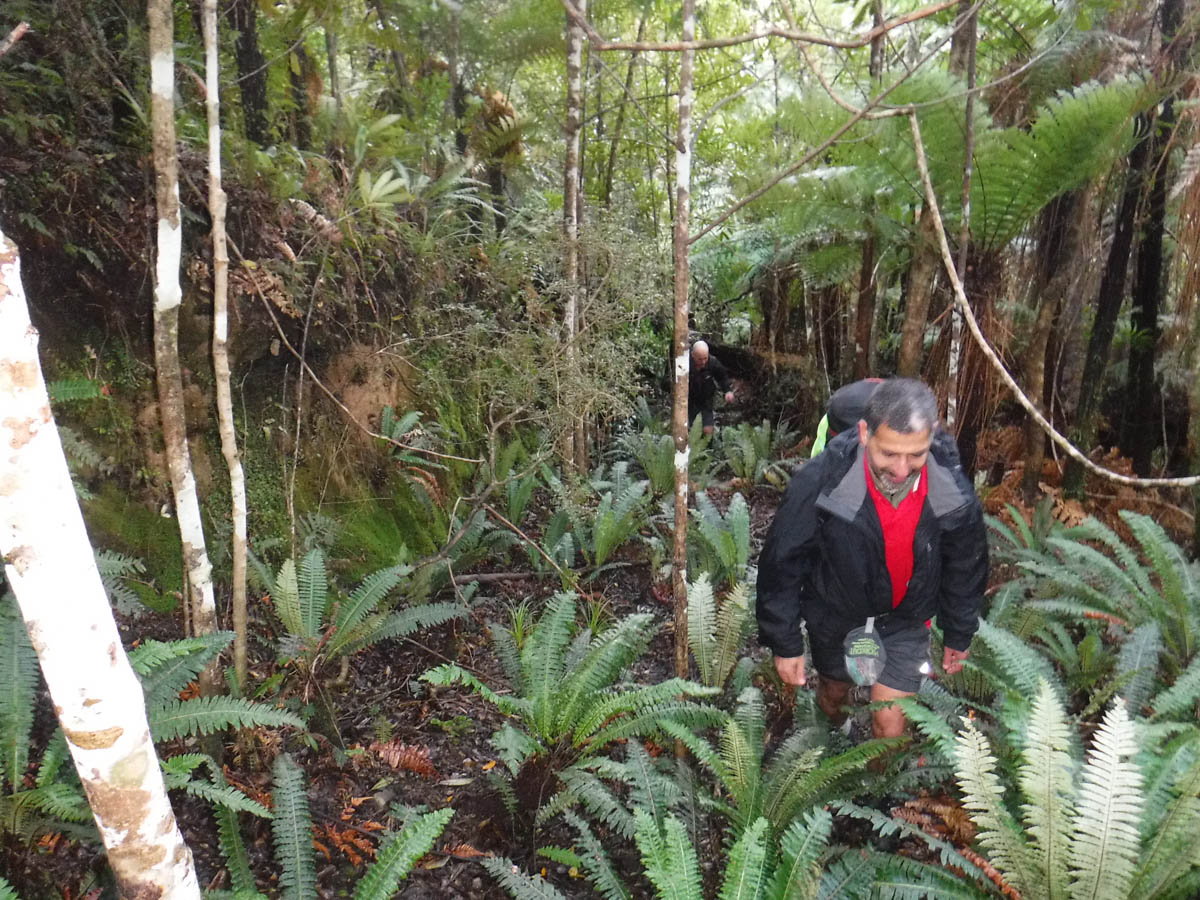
It’s a nice warm up as we get to know one another and form the network of our group.
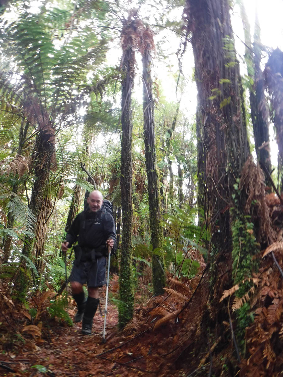
20 minutes in, we reach a grassy clearing – the site of Seed and O’Brien’s sawmill. Back before the Tararua Forest Park was created, huge numbers of rimu and all the other brilliant trees were felled for the timber trade. This south-western area of the park is littered with the remnants of the rapacious industry.

After 2hrs we reach the Waiotauru Forks bridge.
A short climb later we reach a great grassy clearing on a road-sized cutting. A rusting can and a fire pit tell us we’re at the end of 4×4 access from the other end – welcome to historic timber milling country. The grass is low – we soon discover why, startling a family of goats.
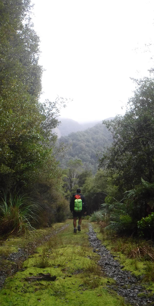
We follow the road; it’s dead-easy, DOC didn’t bother with triangles. If you can’t follow this, you have bigger problems.
The road is easy walking – I get to thinking. Huge effort went into the pillage of the great trees back then; there are cuttings 10 metres high in places to build this road. And the massive trees – such treasure stripped from our country forever, for the sake of a few individual’s pocket books, the value of which is long since lost and forgotten (and probably in the UK). Rapacious is too soft a term. New Zealand was nothing but for exploiting, and the European pioneers were damn efficient at it. But perhaps within the remnants of the greed lies an opportunity – now the more grievous earthly wounds have had time to heal, the tracks are very accessible and quite picturesque. The damage has been done, why not make the area accessible to the casual biker, the child, the trolley-bound senior? It wouldn’t take much, let’s make an asset of this history.
Teenage Rimu grow on the fringes of the road, and it does me good to see them. I may woe on about the removal of all the oldest and biggest trees, but the forest doesn’t care. Give it a couple of hundred years.
A great log alongside the road grunts at us in surprise. We’ve startled a pig. We all steady ourselves, metres away, hiking poles poised in defense against the unseen beast.
We wait, and keep waiting.
Ten seconds later, a chilli-bin sized pig scampers away in a surreally slow manner, down the road and away. ‘We could have stuck it with our hiking poles!’ suggests M – I’m glad we didn’t try.
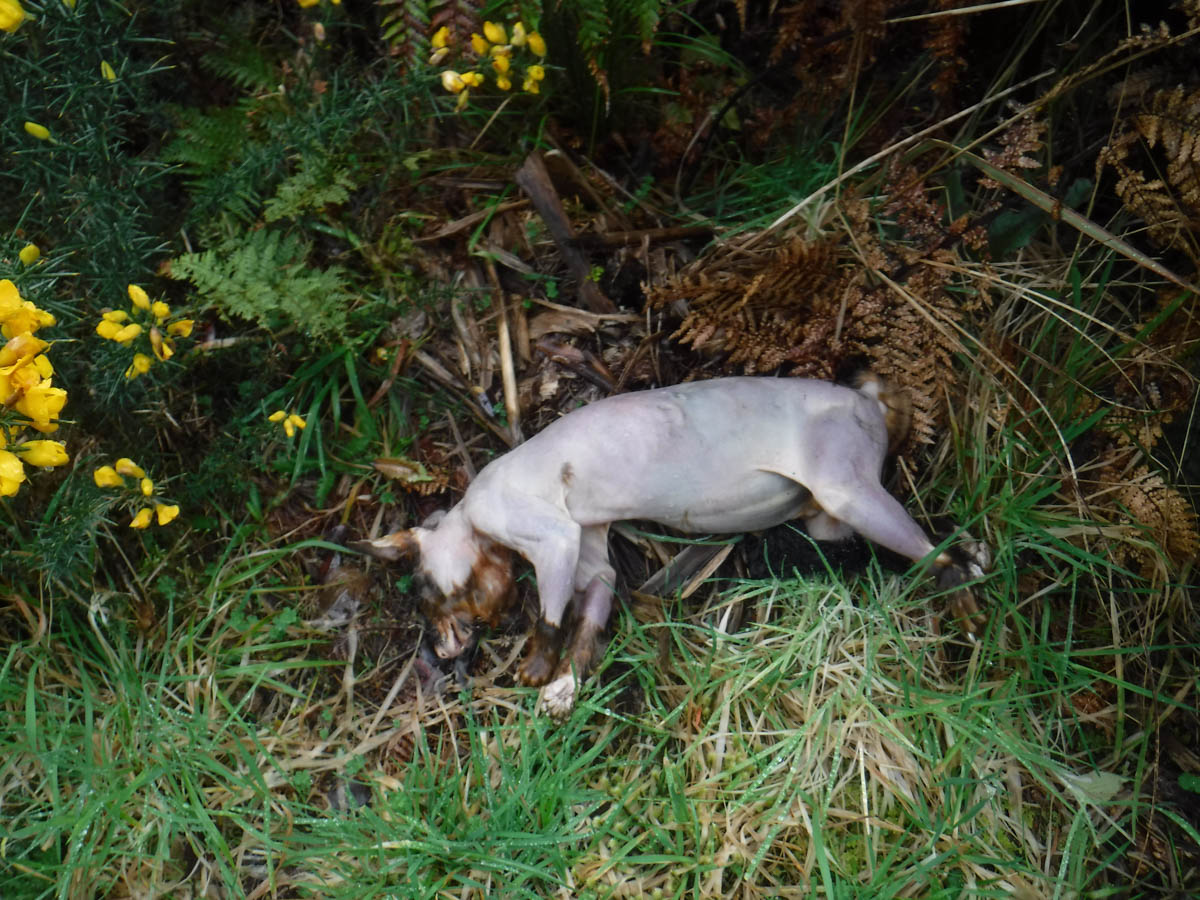
Further on we spot some corpses. They’re cats – no wait, they’re hairless possums. In sets of twos or threes, littered alongside the road. They’re not bloated and don’t stink – they’re fresh, and we’re in 4×4 country.
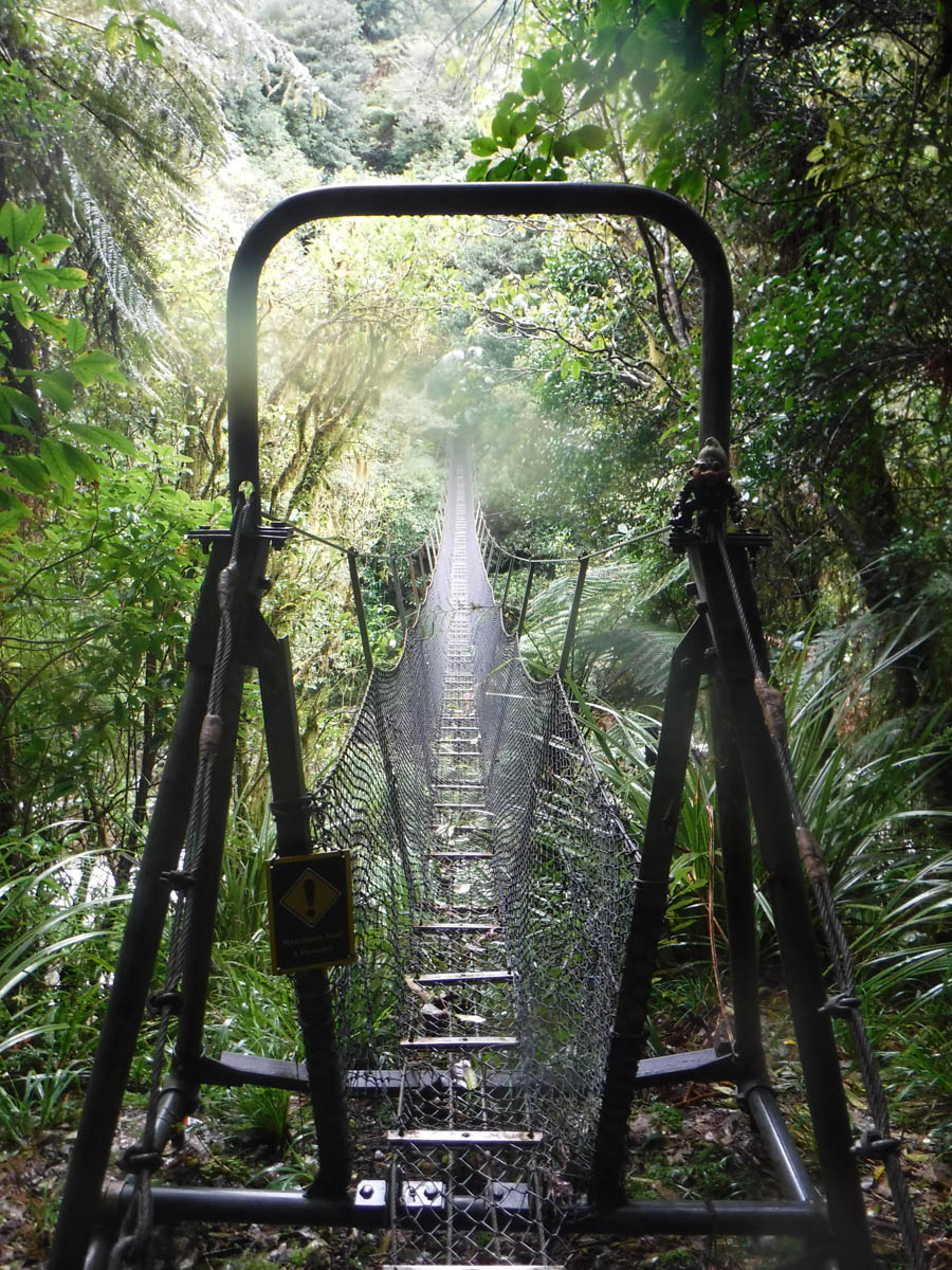
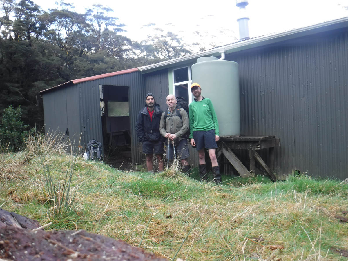
We identify the ridge we’re to climb later (3hrs) and continue on south. The roads improve, and lead us to the river for one final crossing. It’s considerably lower than up at Otaki forks – we get across without completely drenched boots. Waiotauru hut shouldn’t be far away – I am keen to visit the hut with the moniker ‘worst hut in the Tararuas’.
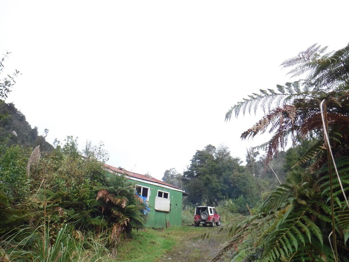
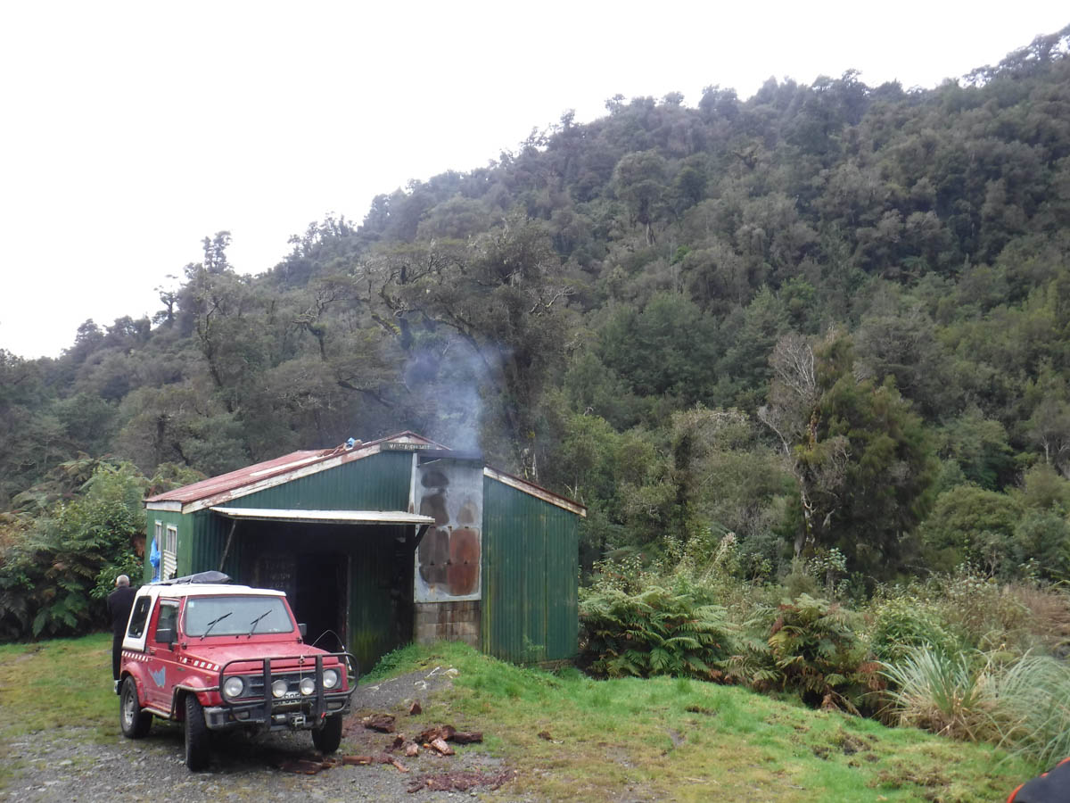
Calling Waiotauru a hut is to be generous. The place is a ruin. DOC’s photos and other blogs are bad enough, graffittied and fucked – the place is worse now. The roof beams are burned, buckled and bending. Upon them perch panels of corrogated iron, a starry sky of bullet holes, ready to drop at a moments notice. An old tarp hangs through a hole in the roof like entrails, dribbling water onto the concrete slab. It’s a derelict in the making – a sad and sorry sight, and a reminder the 4×4 community has some scum who just want to watch the world burn. Those who love the place are pissing in the wind – a particularly collapsed beam is held aloft by a piece of decking timber.
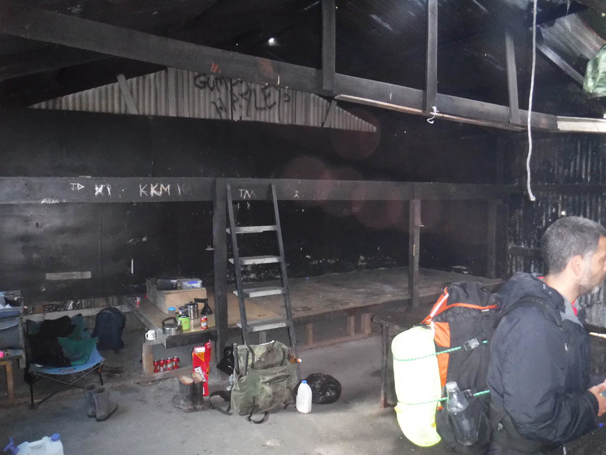
‘I’d love to catch the cunts that keep wrecking the place’ rumbles R, the hunter hunched over the open fire working his way through a box of two doz. double brown. Hard and grizzled, he’s surprised to see trampers out this way. Takes him two hours to weave his wee ute down to the hut.
‘See any sign on your way in?’ he asks. Fortunately I know enough hunter lingo to not ask ‘signs for what?’ and we tell him of the pig and goats. The possum carcasses are his; he traps regularly for the fur. Wondering why we only saw fresh corpses, I realise the pigs must eat them – the first time I really realise there are big omnivores in the NZ bush.
We share where we’re heading and he politely advises us against the route. ‘Fuck no, that shit is a cunt!’
Only a fool would ignore the advice of a local with such experience – we heed his recommendation, bid him farewell and continue south 300 metres to the next creek.
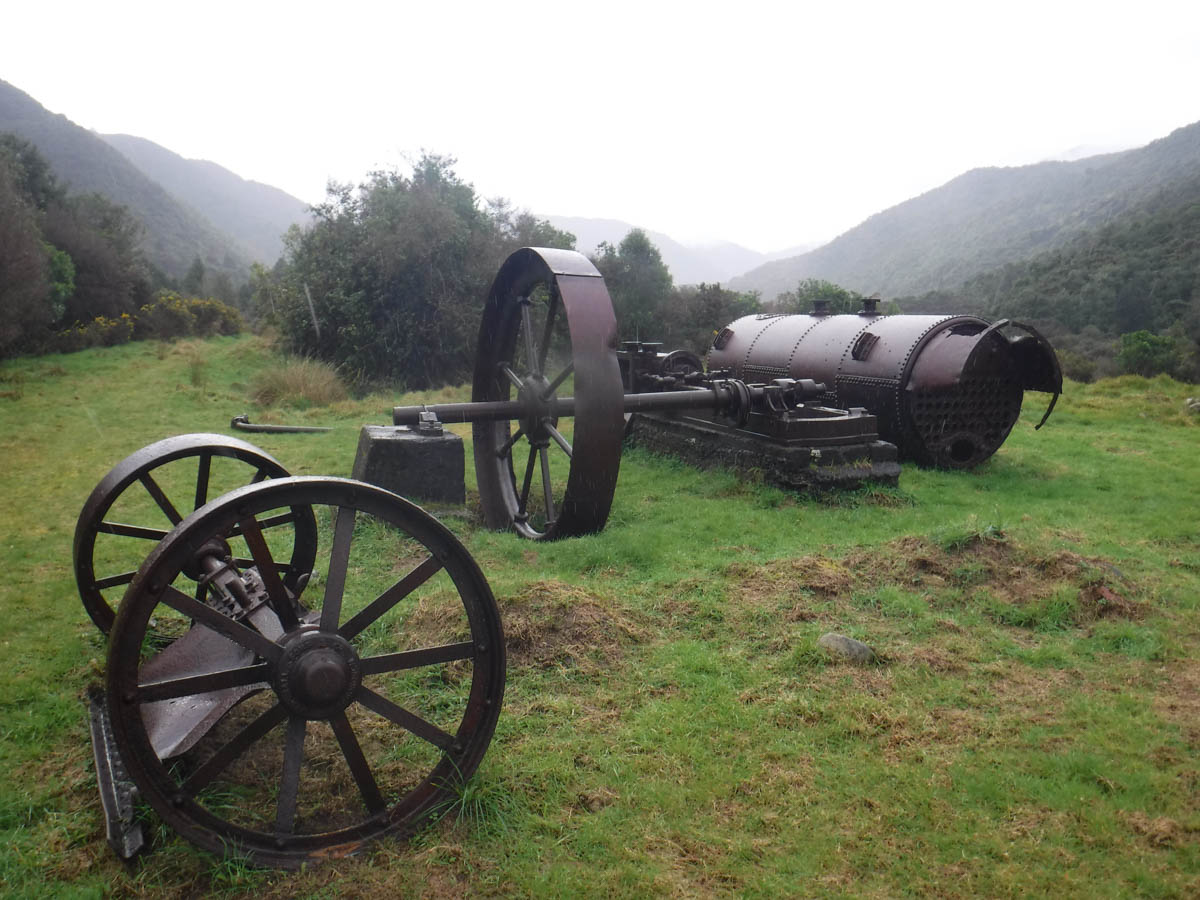
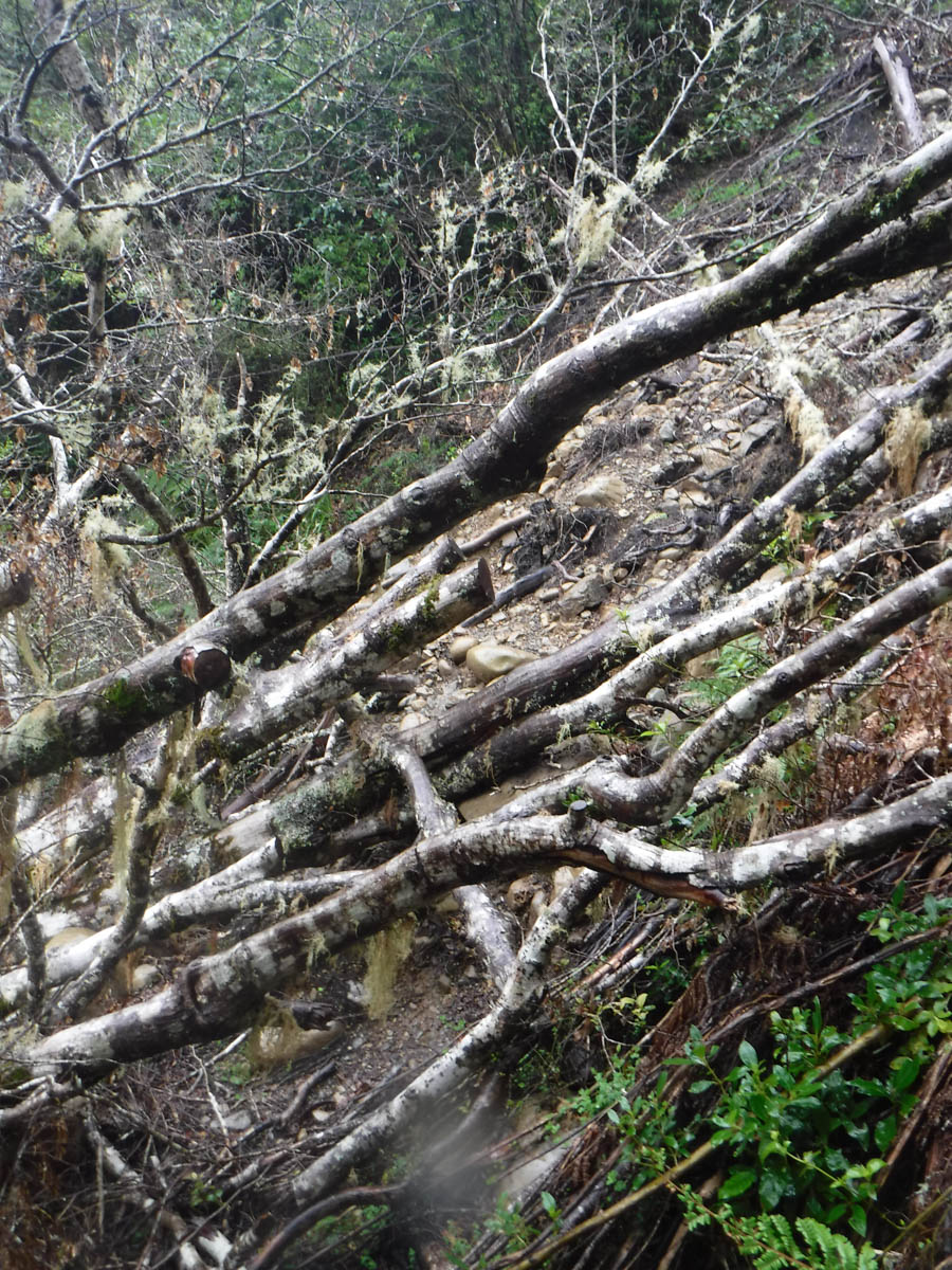
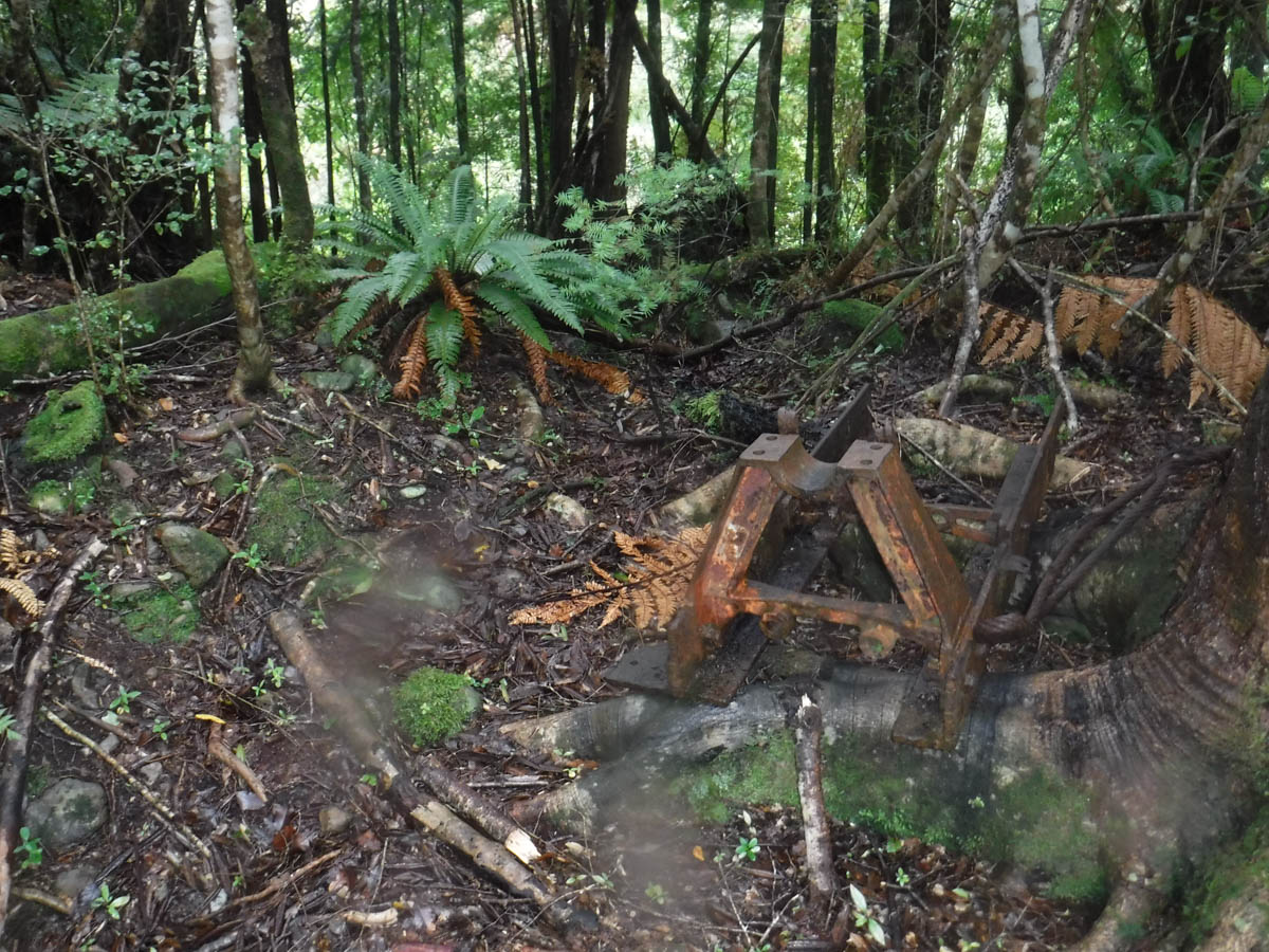
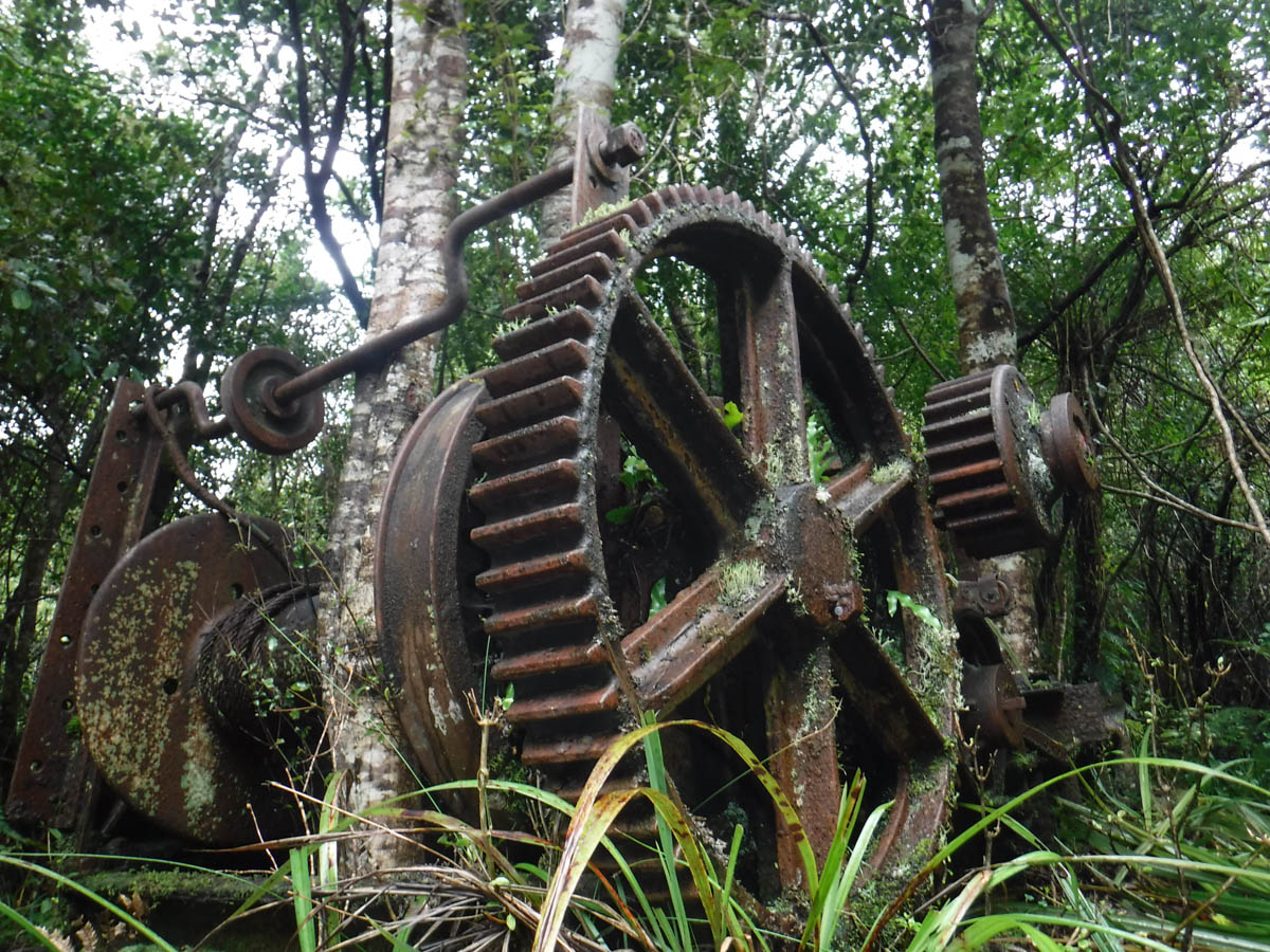
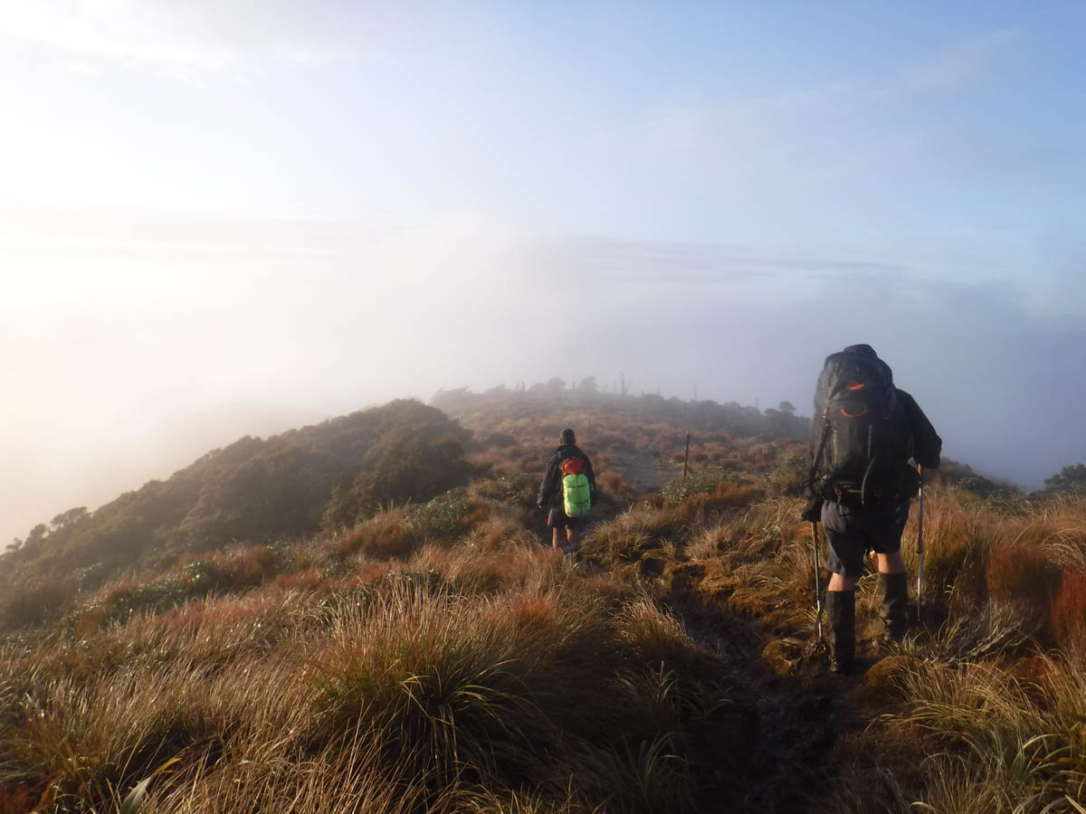
Remnants of a tram hauler rust in the bush. We scramble up the western bank and begin a climb to point 555. The route is criss-crossed with old tram ways. We zig-zag and cut up and over, on and up. We’re off-track- adventure time! It’s hard work – we’re not confident enough to switch-back too much so climb straight up, dragging ourselves by the ferns which help as hand-holds and harm, drawing blood from tired legs.
After 90 minutes Y shouts ahead of us; he’s discovered a track marker – we’ve reached the DOC track linking Kapakapanui to Maymorn Junction. It’s not a well-trodden track, but a track it is – any concern I had about us bush-bashing in the dark is left down on 555.
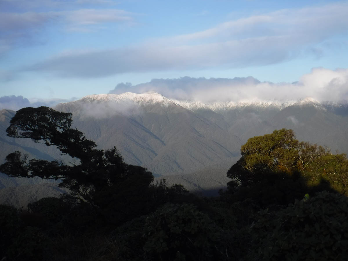
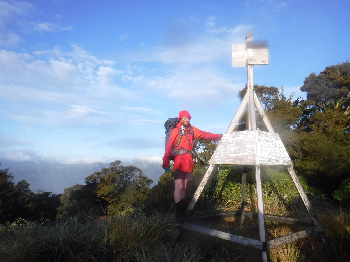
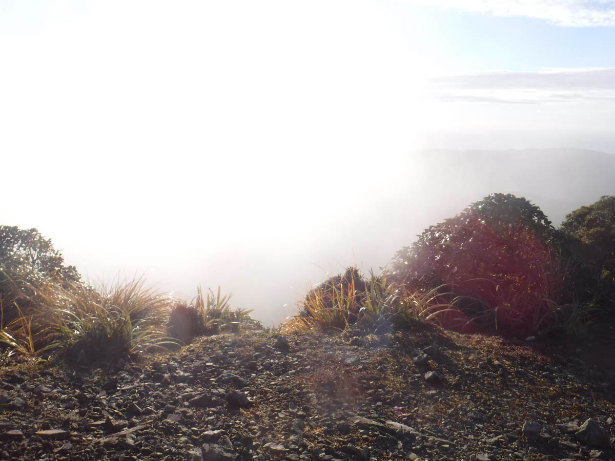
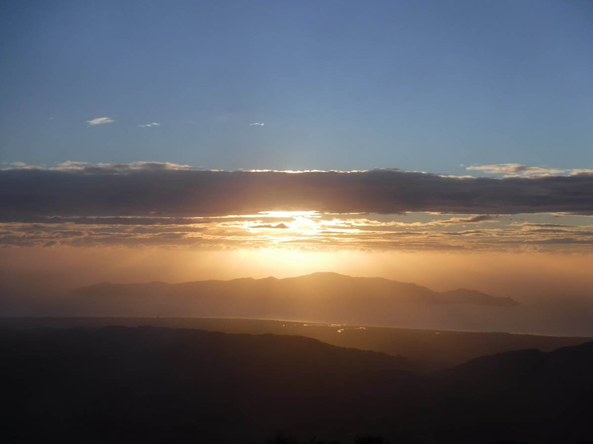
We tire but plod on, rising the last 300 metres to Kapakapanui summit in an hour 20, 6.5hrs from Otaki Forks. We catch glimpses of the snow-capped inner peaks among the clouds. It’s sunset now, and the orange light is beautiful. I need to run timing late more often to be out to enjoy this evening light and these moments.


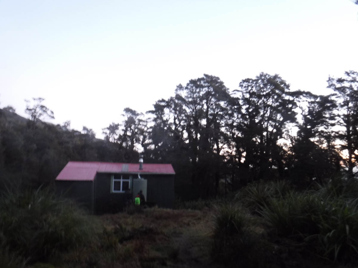
We squelch north along the boggy tracks, reaching Kapakapanui Hut at 6, 8hrs since we left Otaki Forks. There are five in the hut already – two dads with their young daughters and a solo lady. I consider pitching my tent, but that is quickly discarded for the interior floor – it’s a clear night sure to be a cold one, the fire’s going and the occupants are a great bunch.
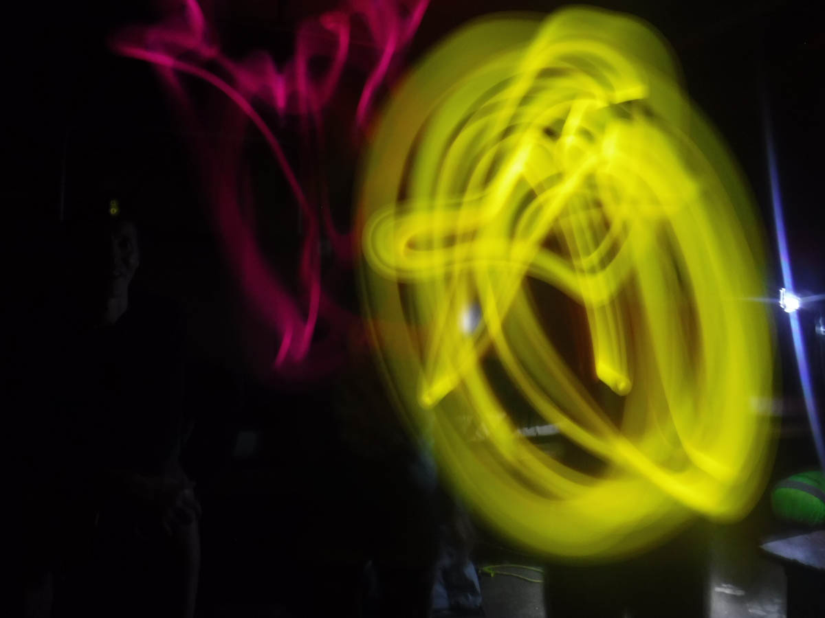
M has a real knack with people and brings the groups together. We crack our emergency glowsticks for the girls, M performs some magic tricks, and I get to talk about Te Araroa.
Rising at 7:30 we have a leisurely morning, leaving at 9:30. We’re looking for a route north along the ridge at point 890, so we keep our eyes peeled on the left of the track. There’s a little foot trail 20 metres or so from the Kapakapanui loo – not it.
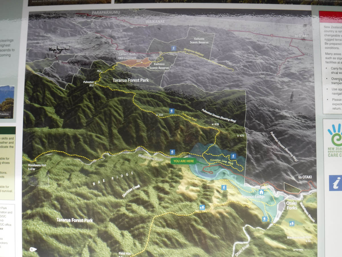
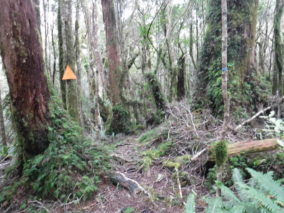
The intersection is pretty obvious when you’re looking for it, on the track 10 minutes SE of the hut, marked with the larger orange DOC markers. They have ‘Waitewaewae’ written all over them, so I suspect they’ve been liberated from the north, but they’re welcome here.
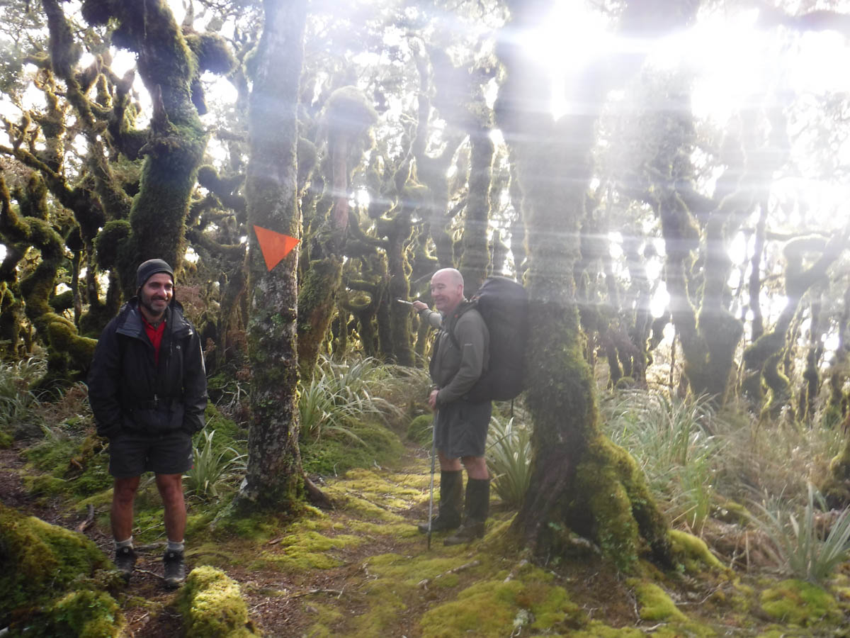
The trail is marked only, and by bits and pieces – string, blue tape, white tape, yellow tape. Little bits here and there to assure us we’re heading the right way, which does anxious Y a world of good. Later he shares with us a harrowing lost-in-pitch-black-bush story, which when coupled with my poor leading yesterday morning explains his concern some! It’s a simple piece of off-track navigation though, north and stick to the quite narrow ridge; M and I love it.
After 1.5hrs we reach more big triangles, also plastered with Waitewaewae notices; the Pukeatua track. We stop for a snack, but not for long – the wind is chilly. Soon it is fast-flying along this very gradual, gentle drop north back to Otaki Forks. It’s a muddy mess in places; gaiterless Y keeps his boots pretty dry, dancing about the bogs; M and I get a kick out of heavy-splopping up to our knees at times.
We lunch in a clearing at 1 and are back at the car at 2 – a 4hr 30 day in the end, far less than the 6.5 I had expected.
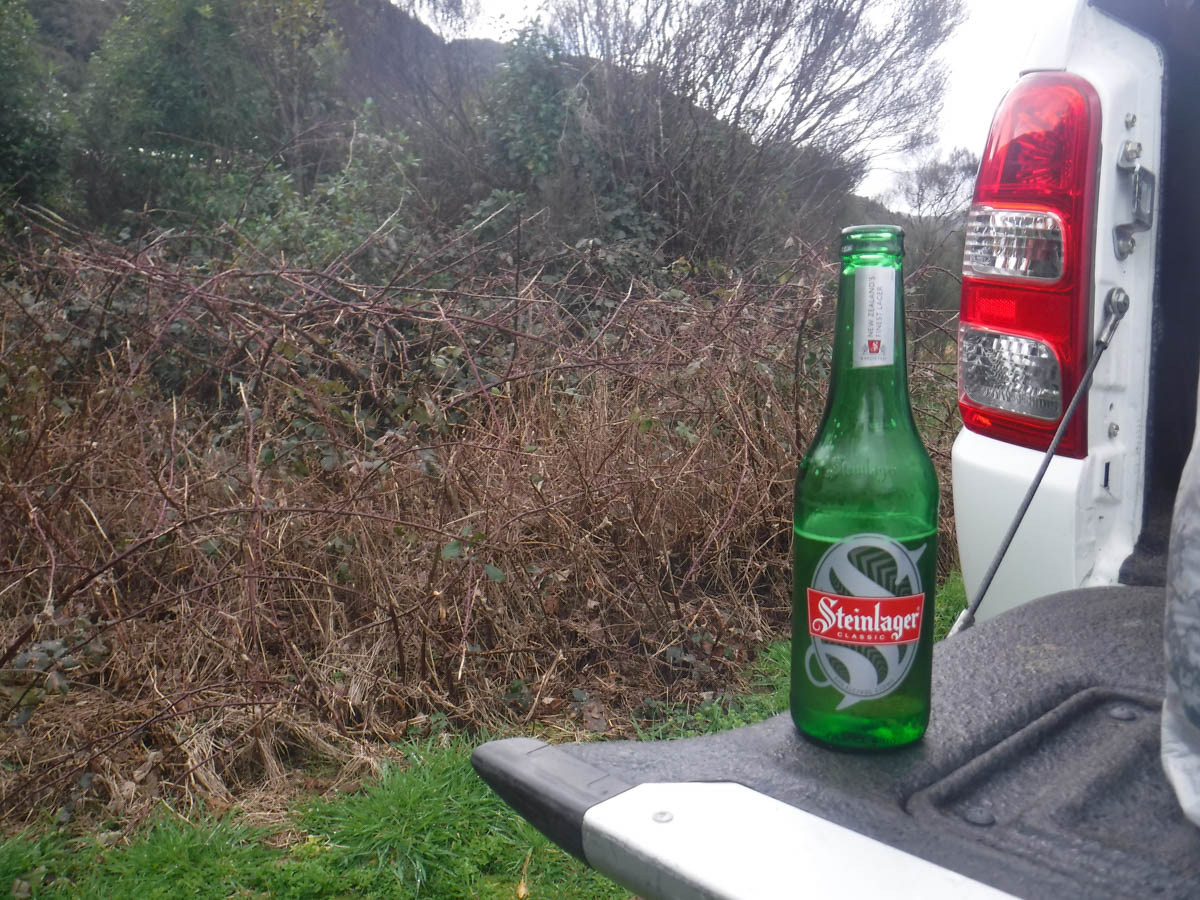
As I get changed, something green passes into vision; a cold beer in the hand of a smiling M. What a post-tramp treat he kept under his hat! And a fine end to a most enjoyable tramp. Length to feel like you’ve done something, varied, slightly challenging but not really, great company and a loop to boot.
Well written and accurate Larry. An awesome adventure with you and Y. I can’t wait till the next one! Ohh and thanks for the museli bars & bier Sticks!
Interesting to the end, wish i’d made it along.
Hey this is awesome – I stumbled on this page. Im doing the same trip at labour weekend – only Im taking in Snowy, elder, renata & thornhills huts too – but I was planning on staying at Waiotaura and your excellent words have convinced me not too, thanks!
That’s great Simon thanks for letting me know – that kind of thing is why I write these! Hope you had a good trip and knocked them all off! Quite keen on the 666-Elder-return via Kime loop at some point in the future.
Hi, just read this post and keen to do the ridge/spur that has point 555 on it (from Waiotauru Hut up to the track that links Kapakapanui summit to Maymorn Junction). The alternative looks like a long trek into Maymorn junction from Kapakapanui and then down the road to Waiotauru. I’ll be by myself and will rely on GPS. How did you find that ‘point 555’ spur in terms of travel and navigation, noting that you went up it and I’ll be coming down from Kapakapanui?