
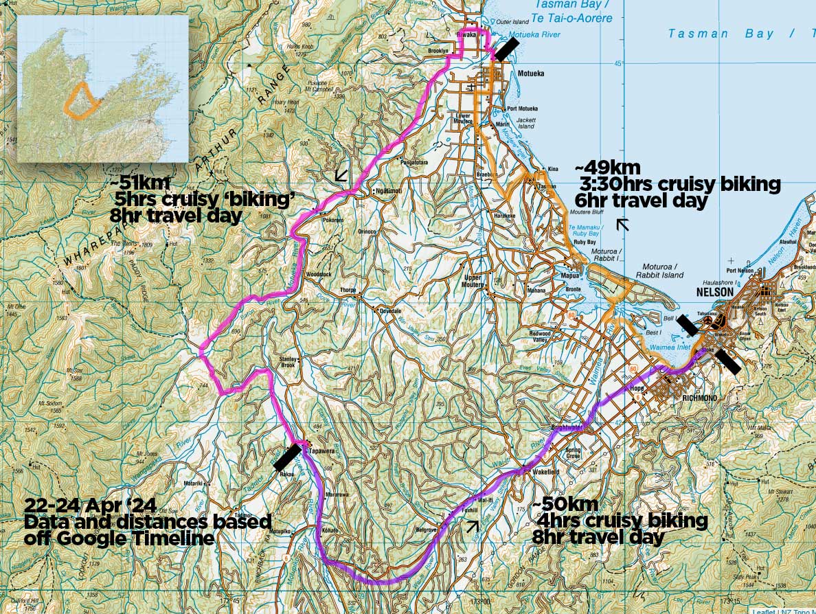
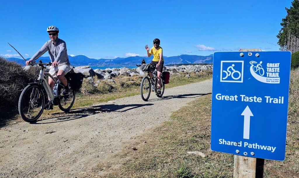
Nelson/Tasman’s Great Taste Trail is a grand 200km biking loop from Nelson, meandering from the CBD along the coast to Motueka, upstream on the Motueka River and back down the Wai-iti and Waimea River plains to the city. All the documentation for it separates it into four quite different sections, but we tackle it as one three day, two night loop to and from Stoke. And it’s an absolute blast. Late April 2024.
Our trip begins in an unlikely place: Queensland Australia.
“Do you want to come bike this Brisbane bike trail with me?” asks my pal Beggs. I do, but nipping across the Tasman is not currently realistic.
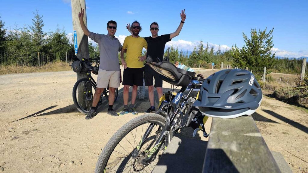
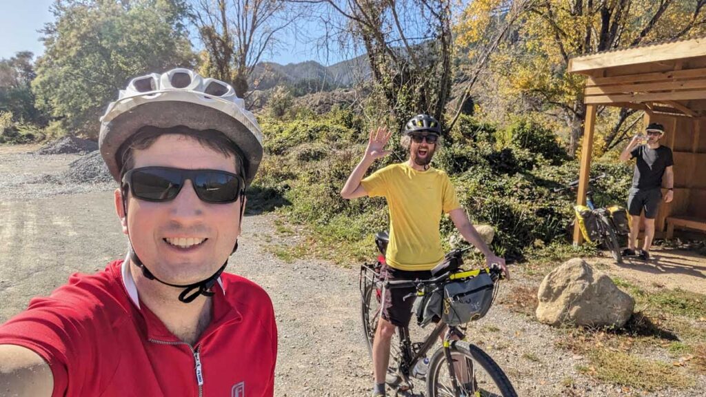
As Claire and I stroll with the boy, we discuss it. How a new-ish father like myself could use the adventure. Claire gives me approval to desert my family responsibilities for a couple of nights – go live – so I get to work on Beggs. ‘Why don’t you tack a ride onto Whitty’s 40th birthday party and come to Nelson instead?’ Beggs, one of my oldest pals, is also a new-ish dad jonesing for an adventure, semi-friendless in a foreign land – and it does not take much convincing.
As the time draws nearer we realise another dad may also enjoy a non-parenting moment we’re longing for – our mutual other oldest pal Kev. We throw the bait and at the last moment we catch him. So caught up are we (or maybe just I) in the concept of escaping dadhood, we don’t think of others who may have enjoyed this too.
The Great Taste Trail
The Tasman Great Taste Trail is part of the New Zealand Cycle Trail project. I’d like to just remind/share this is a John Key National Government legacy project from 2009. The idea, which is quite clear once you’ve biked a few hours, is that cycle tourers spend money. They stop at every cafe, every dairy, and stay all over the place, when car tourers may not. While walkers are generally unemployed self-sufficient tightwads and can’t deviate from their route (ala the Te Araroa walkers), and freecampers just go from pak’n’save to pak’n’save, bikers can’t carry two weeks of groceries, but have a bit of freedom – and jobs/money – to enjoy themselves. It’s a great way to get money spent in regional towns I am so in support of. I would love to see that concept of the full-national bike trail re-invigorated for the future, and am pleased to see funding allocated into Otago areas of it in 2023.
eBikes were a bit of a novelty in 2009 – today I think the model is proven and makes even more sense. Perhaps our current government can get those bootcamp kids on the cycle-trail chain gang (!) and round the NZ cycle trail out, if it’s still a cross-Political Party winner.
But enough of that; on with our experience of the Tasman Great Taste Trail.
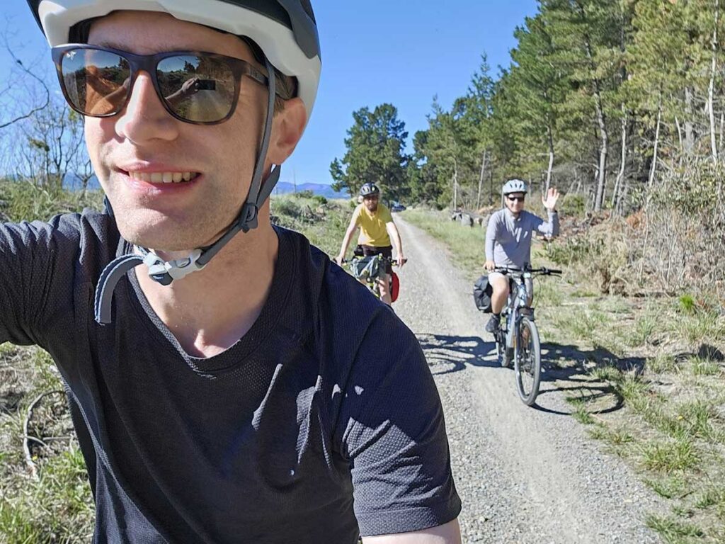
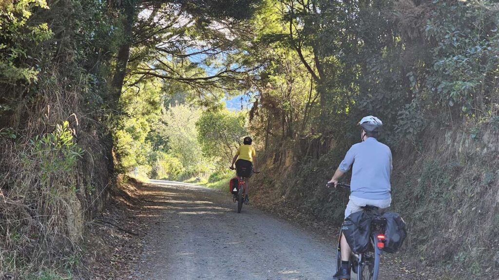
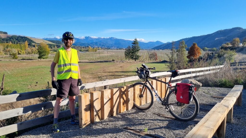
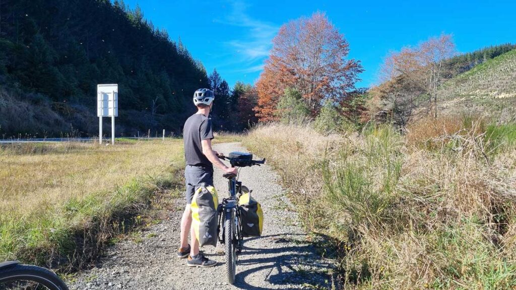
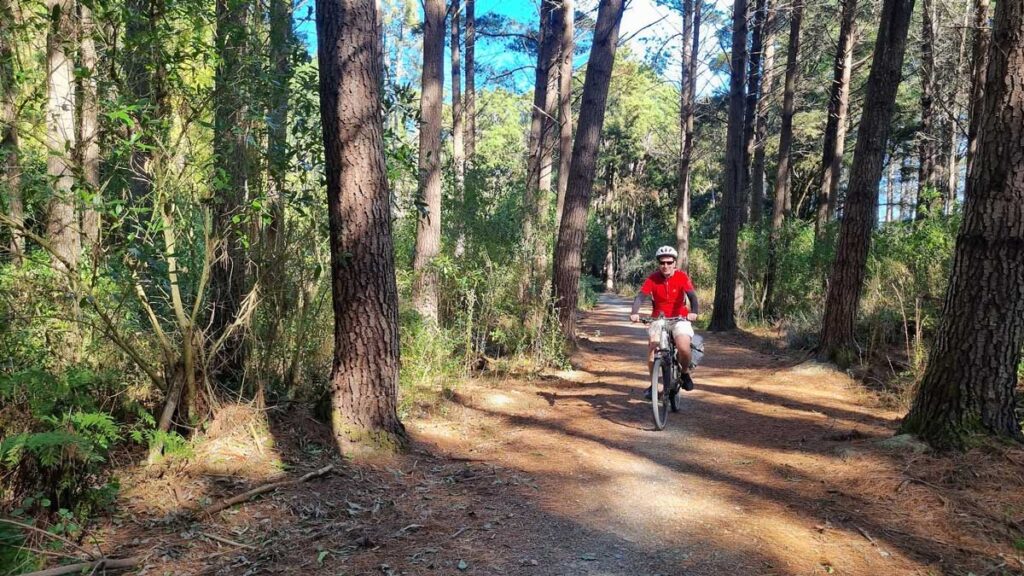
The morning of our departure from my place is leisurely; bacon and eggs and heaps of coffee. Beggs wanders over to the airport to pick up his rented e-bike, while Kev borrows a local guy’s bike and I use my own.
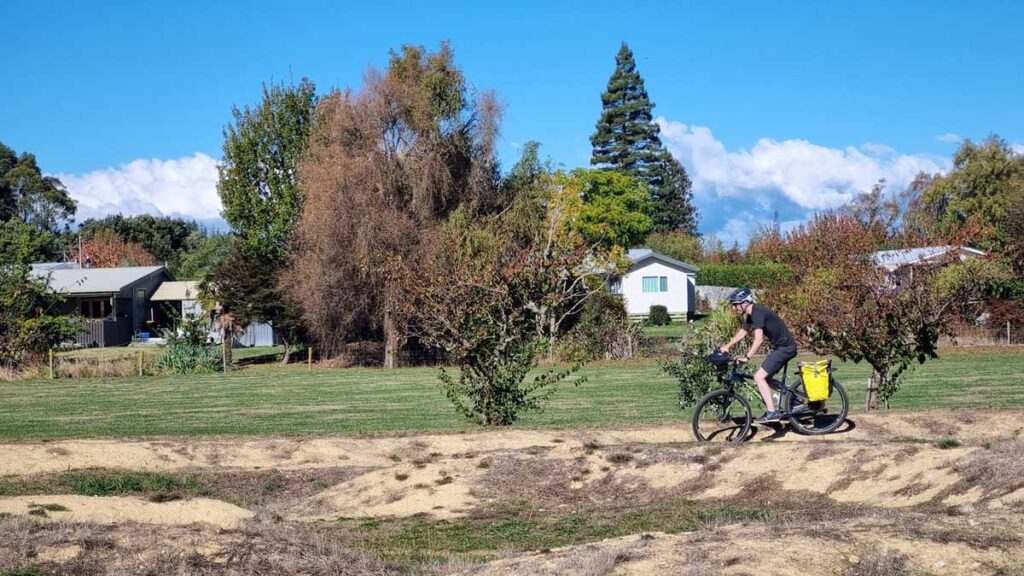
We hit the road at 10am, and struggle into headwinds blasting from the valley to the sea. This is the route I take the little man to daycare sometimes so nothing exciting to me, until we veer off along the coast. Last time I came here was on the Tour Aotearoa in 2018.
It is just as lovely as then – but with better company.
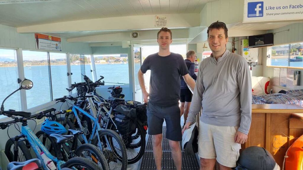
We plan our mucking about for the Rabbit Island/Mapua Ferry. It’s a short trip across the river mouth, and we time our arrival so well we only wait a few minutes (it runs ten past the hour).
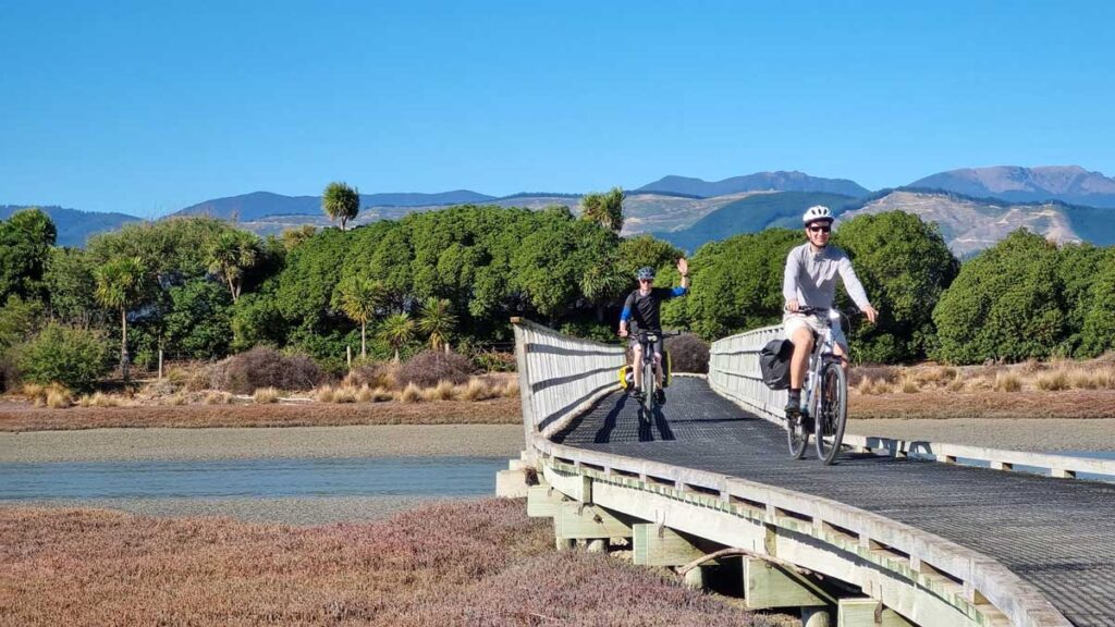
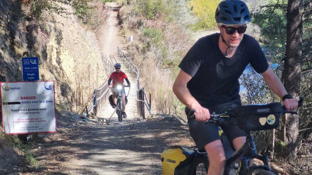
On the way, we cross the C.B. Kidson bridge; a cycle bridge over the Waimea river that’s claimed the limbs of a few recently. I had read about it earlier, but thought it’d be another bigger bridge later. This bridge isn’t even that big. But sure enough, about halfway over, the swaying or oscilation or whatever makes our front wheels weigh nothing. It’s absolutely out of control. We all make it over but it’s an interesting physics experiment – and the authorities are all over it, it’ll be fixed before you read this probably. Or alternatively, if the ‘fix’ is just a sign saying ‘ride one at a time’ – I suggest you follow the advice.
Mapua has a lovely vibe and a beautiful biking forecourt. We critique the bike racks though; they’re beautiful but useless, and while there’s bikes everywhere, nobodies using them. Though to be fair, with 26″ or 29″ rims, fat or thin tyres, front discs and so on, a universal bike rack is a tall order. At least they look nice.
It being Monday, some of the pubs are closed. But we opt to forego a meal anyway and continue on, to try our luck with a lunch in Tasman; a town that exists but is somewhat eclipsed by the region of the same name, and the bay, and the sea. The general store greets us after an enjoyable downhill past a fun deviation from the ‘Jokers retreat’?, and I eat a pie. You’d think it’d be the first of a few pies but it is the one pie of the ride – fortunately it’s a nice one.
On the way out of Tasman we pass the local pump track, and while Kev tests his borrowed bikes capabilities, Beggs liberates an unidentified citrus fruit from the public supply; either an unripe green something or a beautiful lime.
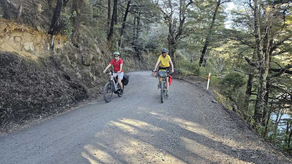
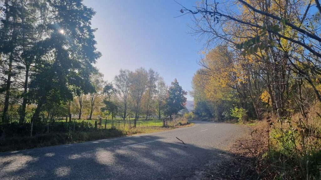
Just after Tasman we take a hard turn left and crank up Harley Road. It’s an almost 100m climb at the hottest part of the day, but we toddle along admiring the views of the many mountainous lifestyle blocks, all too new or parched to have surrounding vegetation. From the top we sweep along the ridge of Tasman View Road, past forestry.
I am glad Kev came along and is on a regular bike. Beggs’s eBike rattles along patiently behind us. Beggs puts one rotation in for every six or so of mine up the hill, as some unknown plastic rubs on the chain and creates an awful noise whenever the bike is being used. The kickstand is too short too; you may expect (and should demand if you notice!) better from a rental bike twice as expensive to rent as a car. Though that said it probably costs twice as much as our car.
At the high point (121m), a sunshade, seat and panorama view explainers give us a nice excuse to rest our butts.
The downhill is gravel, but pretty tame and unterrifying. We soon split off across rolling farmland, the autumn leaves looking very Wordsworth English twee.
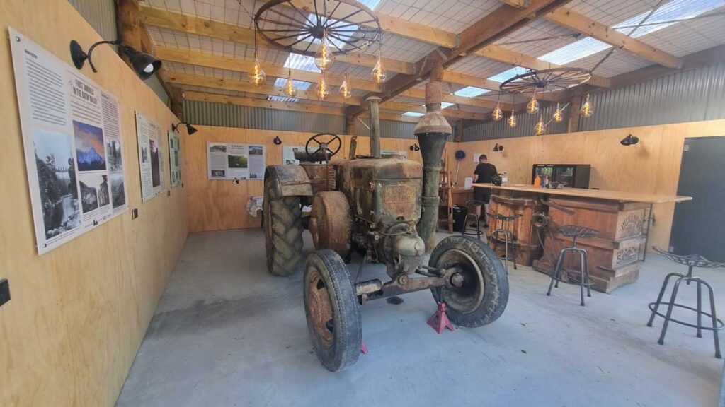
As we roll into Motueka we lose the trail entirely. Eventually we criss-cross around the side-blocks of main street to our accomodation, the Nautilus Lodge. It’s a fine evening – the bikes are locked up in the garage with Beggs’s on charge. “The most I’ve had in here was 22 eBikes charging” the handy manager tells us – must have been a busy garage! I learn many of them only charge at like 2 amps, same as a modern cellphone.
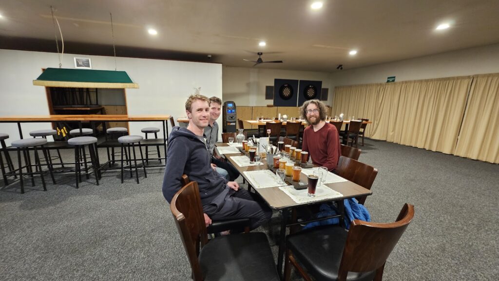
We change, wash and toddle off to the Sprig and Fern tavern for dinner. This could be called the Sprig and Fern Trail; there’s eight of them advertised along the route. Not a bad thing, but we later opt for variety!
Bright-eyed and not hungover we wake and decide to breakfast in Riwaka rather than Mot. Our fingers freeze as we get started early today; but not for long as we get waylaid talking to a local fella. It’s a different pace out here, and everyone’s into having a yarn. It is quite charming provided you’re not in a hurry – which we’re not.
At Riwaka we breakfast at the only option, Mrs Smiths Cafe and Vegetables. Bloody good breaky. From there we have pretty much our only navigational challenge of the trip: avoiding the trip to Kaiteriteri. The route suggests we pop over and have a look, but we’re on borrowed time, every wife-and-mother-goodwill-eroding minute. Basically the challenge was the sign to Kaiteriteri comes ahead of the turnoff to not Kaiteriteri. It’s like 20 metres too early. That’s it. Otherwise the signage on this trail is stellar (except in towns, but I suspect that’s intentional).
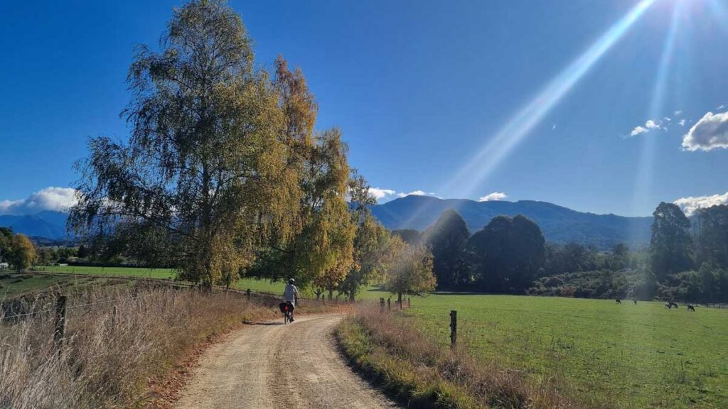
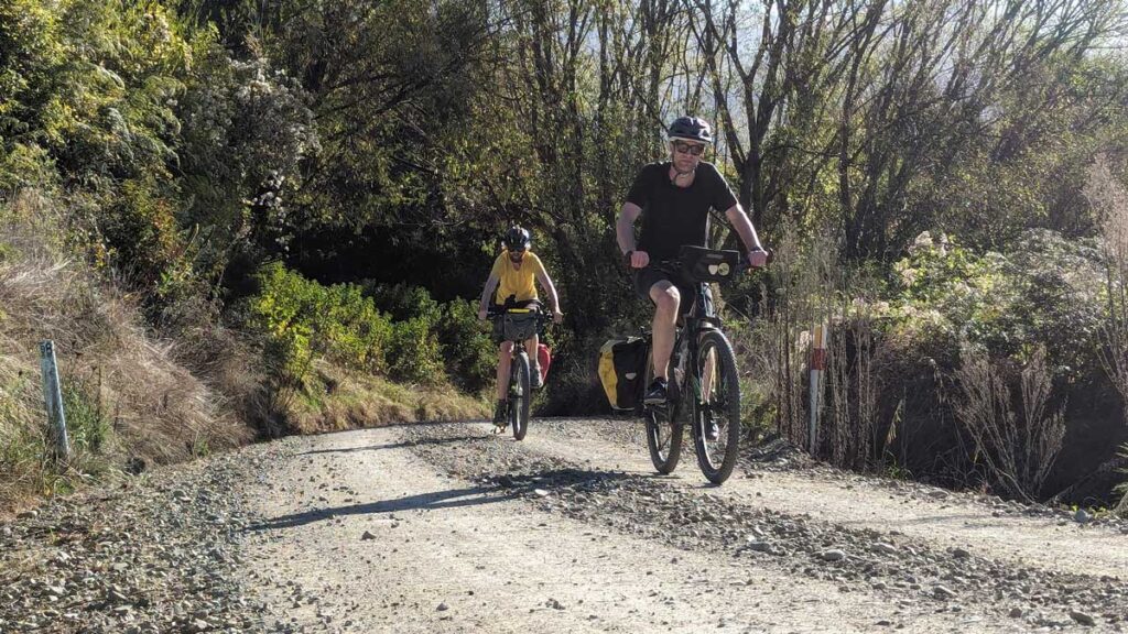
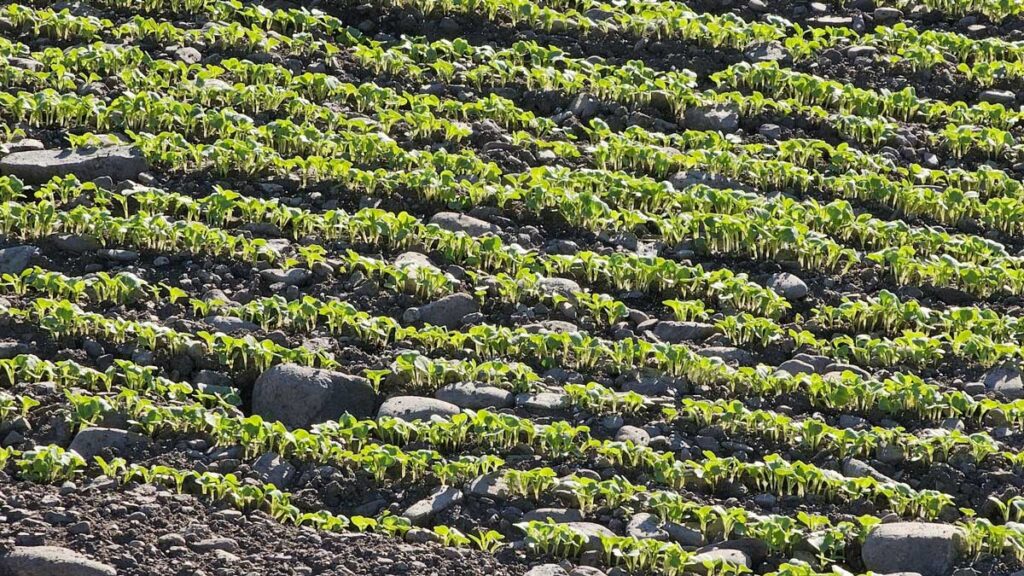
We cycle between orchards and marvel at the apple harvest while heading over to Motueka River West Bank Road. This is a pretty quiet sealed secondary route servicing the orchards and lifestyle blocks and little else; after 9am it’s chill as. We still do the old “car” call. At one point there’s two cars, but you don’t hear the second and presume it’s just one, and almost swing out into the second after the first has passed. I share that to remind all to treat every ‘car’ as a convoy until you can clearly hear the tyres disappearing into the distance ahead – i.e. always assume there’s another car behind!
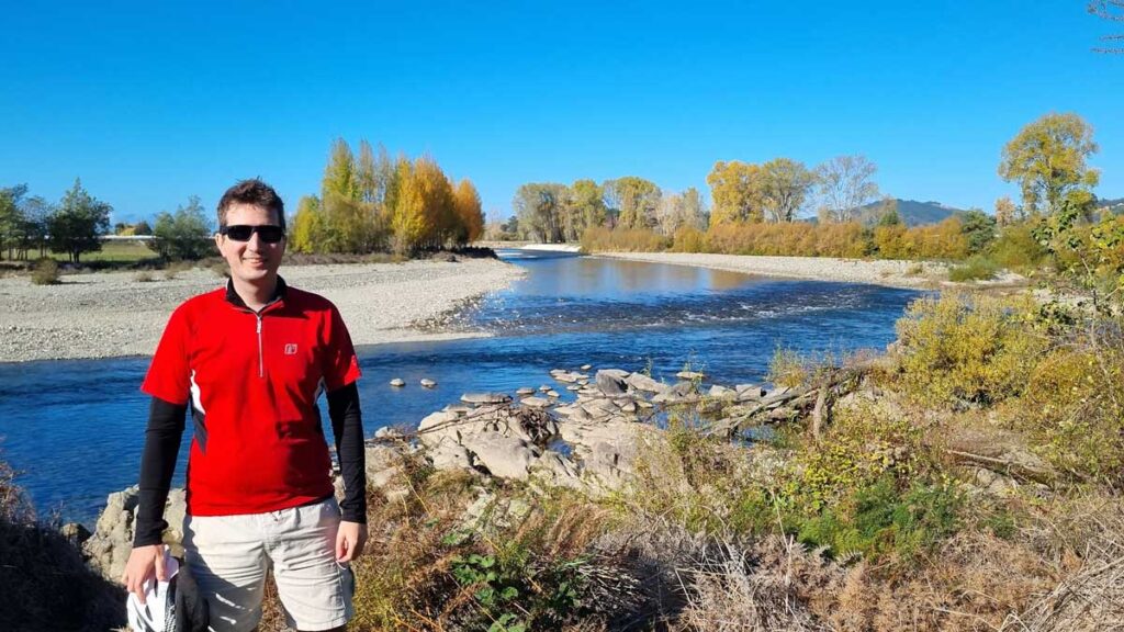
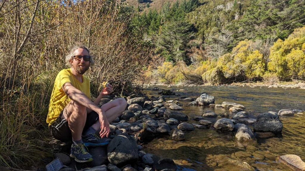
Some great views along the river. Autumn is a great time to ride. It’s not hot, the summer tourists are gone, and the trees look great.
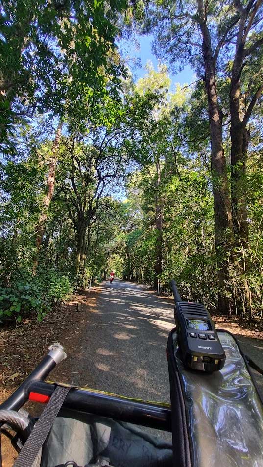
We brought my radios along. I haven’t ridden tours with others that much, but I recalled from a little pushbiking and motorbiking with others, feeling like the person at the back never gets to make a call. By the time they see something interesting the guy at the front is out of sight. The ‘are they following or aren’t they’ dance is a tedious time wasting logistical meh. So I take the radios, and I have one and Kevin has the other. But we meander very well as a trio, never need them except for novelty; though it’s peace of mind to have them too.
The local Rotary have installed about four shelters along the route. They’re fairly new, not smashed up or graffitied, and provide a welcome shade and wind break at good spots along the way.
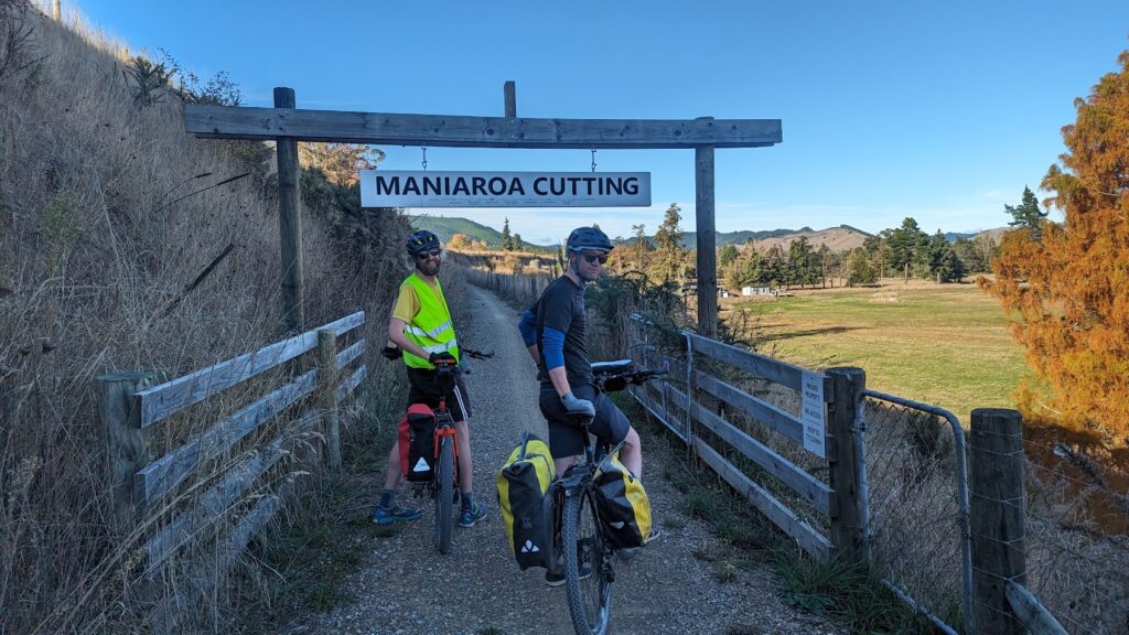
Unfortunately for us, when we leave the Motueka River for the Baton and the upriver road meanders its way into gravel, it’s nice fresh gravel. We slip and slide and cut across the middle slippery pile to the lesser crap tyre track for many kilometres. It’s a stinker on a nice afternoon, though we know it’s very temporary to be like this and it could have been much worse! There are some lovely bits that aren’t all fresh gravel as well, swinging under steep ridges amongst the beech trees.
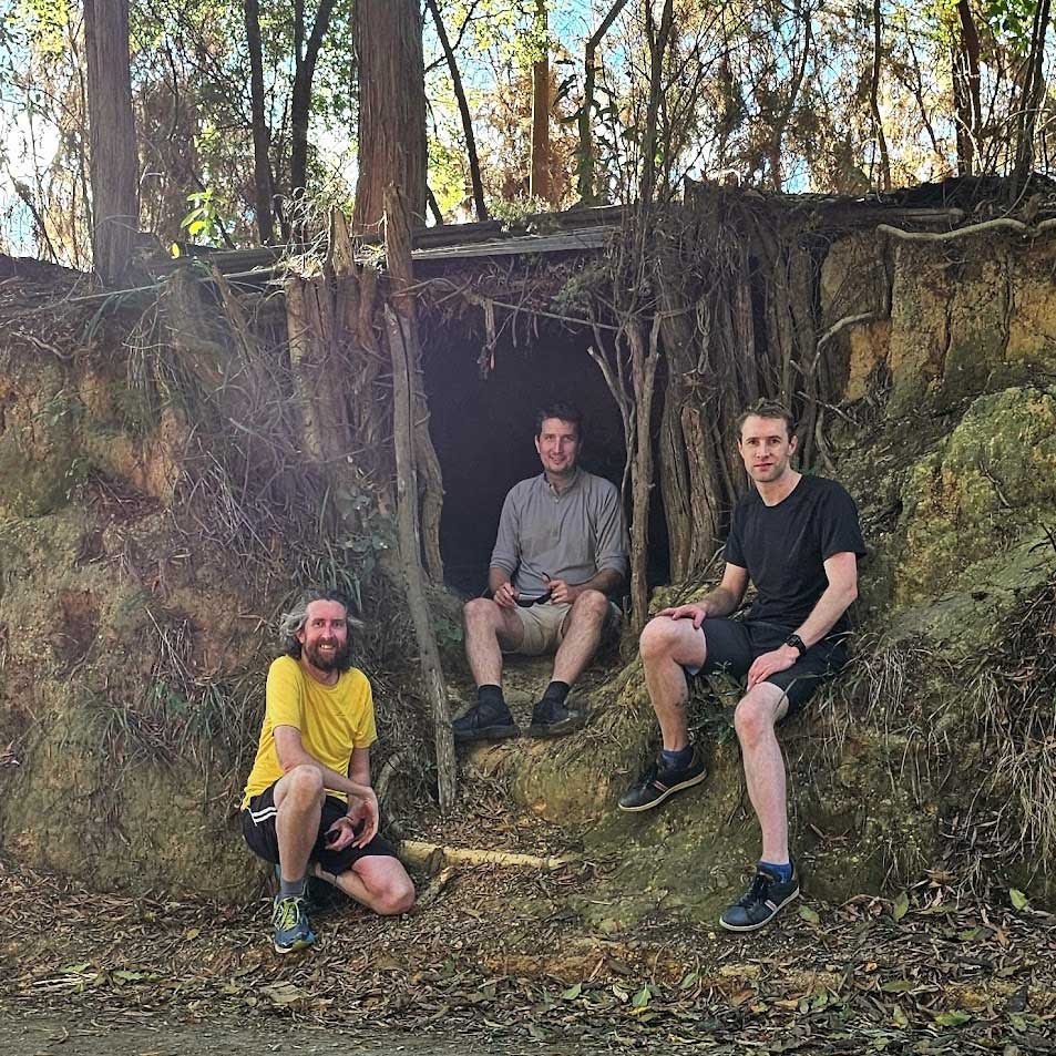
As we climb up Baton Valley, signs for Ludlow’s Leap keep popping up. ‘6km to ice cream at Ludlow’s Leap’. I am enthusiastic but pessimistic it’ll be open, this isn’t peak season! But when we reach the spot, my heart! There’s an entirely trust-based wee store open. Cold drinks and ice cream, with a paywave machine and a ‘help yourself’ aspect. With no cell reception out there, there’s even free wi-fi for those who can’t get off their phones. We enjoy a nice wee ice-cream reading up on the history of the area – but what I am most happy with is that this is a thing. People aren’t dicks, it’s wild. We suppose the local louts would we well-known to everybody here, caught on camera, and easily trapped up the valley on the one-lane road, which provides some dis-incentive.
Beggs forgets his drink bottle here, desecrating the ‘leave it as you find it’ mantra of such a spot. Outrageous! Fortunately the eBike is doing most of the work and with just a sip or two from Kev and I’s he’s all good.
A new bridge was put in in 2022. This opened up the upper Baton Valley area for inclusion in the trail, which is awesome.
Across the new bike bridge , we are faced with our big climb for the day, up to Baton Saddle. It’s a 120m climb, and relatively steep, but it’s fine; it’s just the end of the day that does us! We creak and groan up to the saddle top.
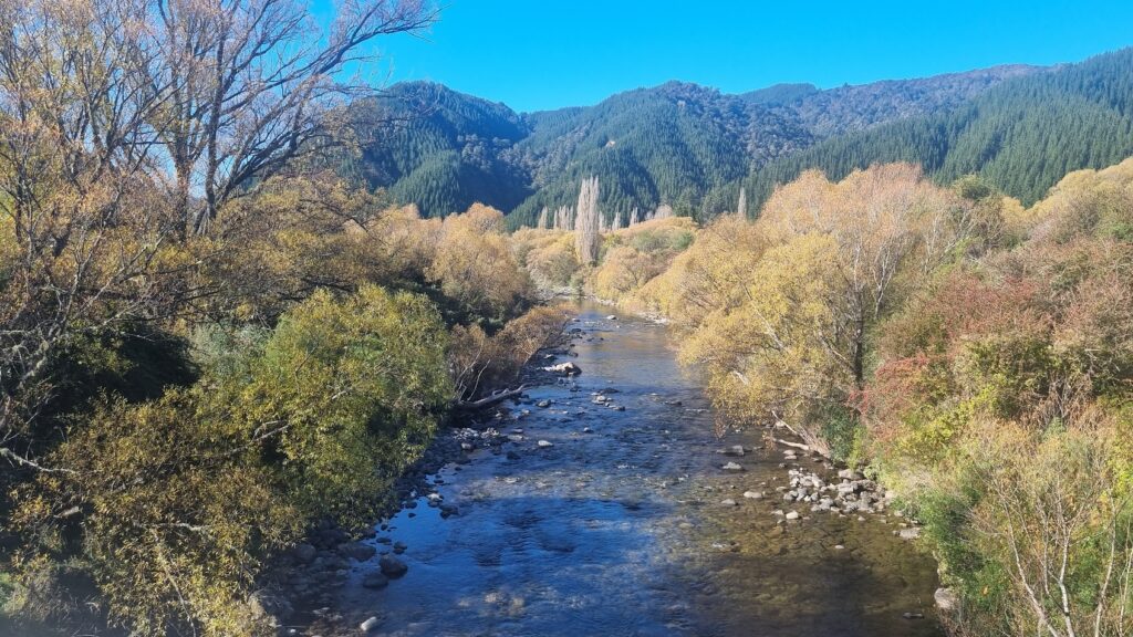
From the saddle we rip on down Baton Road. This is one of my favourite bits of the ride, tearing along the creek on a gently bending downhill road. The distance we make just rolling off the backside of the climb is pretty great.
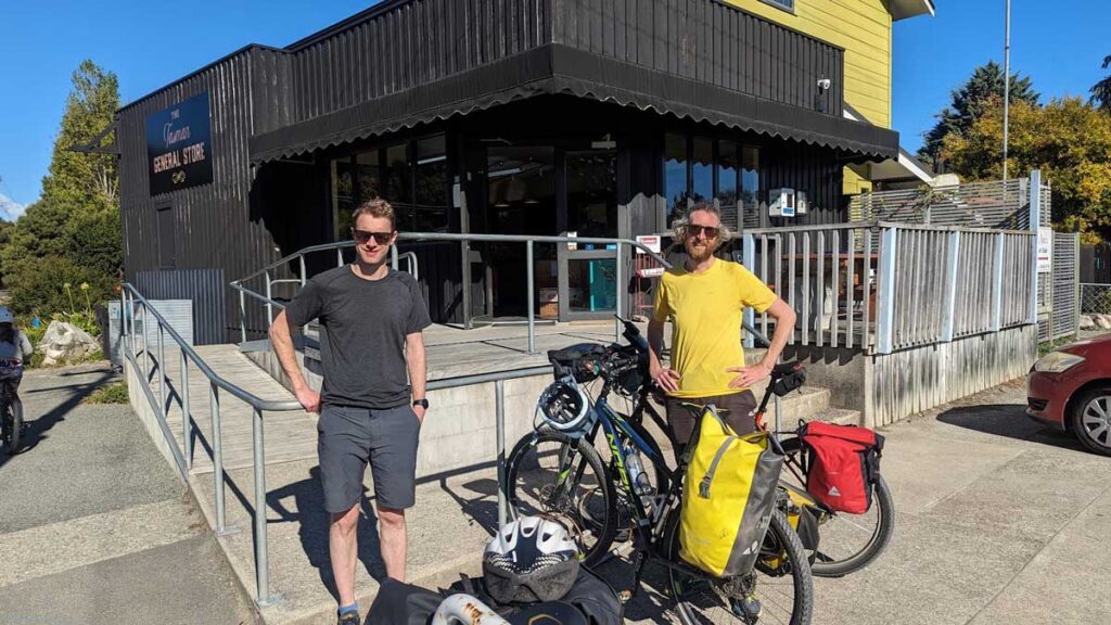
From there it’s just following the road to Tapawera, where we spend our evening at the Tapawera Hotel (now the ‘Hop bar’ and bottle-o). It’s just shut for renovation – our host tells us they cannot handle capacity during peak times so they’re increasing capacity etc, which is cool – but Beggs wrangled a room, a meal and a beer tasting anyway somehow.
It turns out this was all for us, a private dining experience. Great hospitality, great fun – loved it. Highly recommend. We had bunk beds in our room, but it’s the first time I’ve seen bunks where the bottom one isn’t attached to the top. Amazing! So I didn’t drive Kev spare tossing and turning through my night terrors, bed wetting and so on.
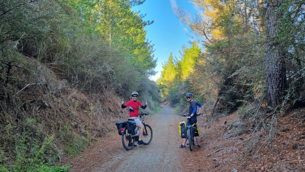
The morning greets us with another sunny and fine day, and we toddle out of town along the trail right behind the hotel. This is old railway territory, following the line of the old Glenhope-Nelson railway. This was meant to punch all the way out to Westport but it didn’t get completed, and the completed sections ceased use in 1955.
Now the rail cuts are a handy bit of bike trail, un-mothballed after 60 years to form this leg of the Great Taste trail in ~2016 ish. Sorry I didn’t read every sign since I was gasbagging with Kev and Beggs most of this trip.
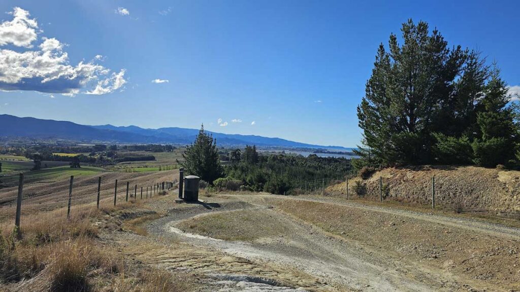
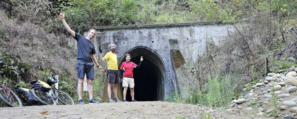
After a quick cuppa in Kohatu – where we share our massive improvement ideas for the map of this trail to nobody – we crank on up to the Spooners Tunnel. This is a bit of a highlight, and not because it’s the high point at about 300m above sea level and it’s downhill all the way after this.
Spooners was re-opened for the bike trail in 2016. The longest bike tunnel in the Southern Hemisphere, it cuts through the mountain for 1.4km, saving us another 100m of climb.
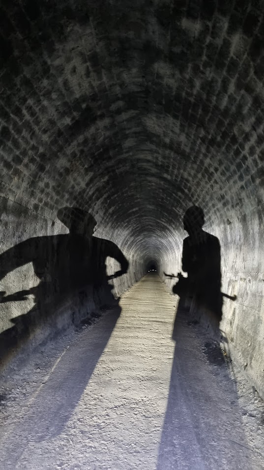
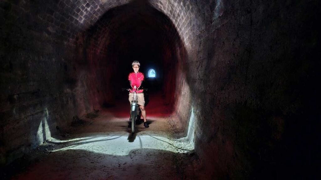
Within the tunnel, we spot lights. Children and parents. The kids form an honour guard of lights as we ride between them, but as we pass, they begin to chase. ‘Speed up Kevin!’ laughs Beggs at the back, kids running behind. He toots his eBike horn which is quite the scooter horn and the kids shriek in delight.
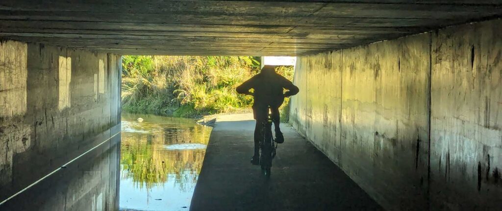
The tunnel is chilly but very well kept; dry as and no potholes or anything to catch you out like I’m more used to expecting from the Rimutaka Incline.

Another downhill joy comes right after the tunnel, ripping on down in the high 20k’s without pedaling, for about 4k straight. It doesn’t take long!
We shoot by Belgrove and continue on down the hill. Our map pamphlet says there’s a roadside bit here somewhere, a bit along the side of SH6; but we don’t really notice it. It’s no worse than the track next to SH6. I’m all ready to rip and bitch about a private farmholder not giving even 1 metre of their roadside wasteland to the local economy but in my face, it’s unnecessary.
We head off and skirt a chicken farm, enjoying easy (generally) downhill single track. We pass a dark skies domain, Wai-iti domain.
Winding along the river to Wakefield from Glenhope is another highlight. Easy downhill, great for a kid someday. All too soon we arrive in Wakefield, and I share some local knowledge from Claire and I’s study and stay of the place when eyeballing the region to settle.
Wakefield is one of first places to be settled by Europeans back in ~1830. There’s the oldest school, the oldest church, the oldest… Nixon statue.
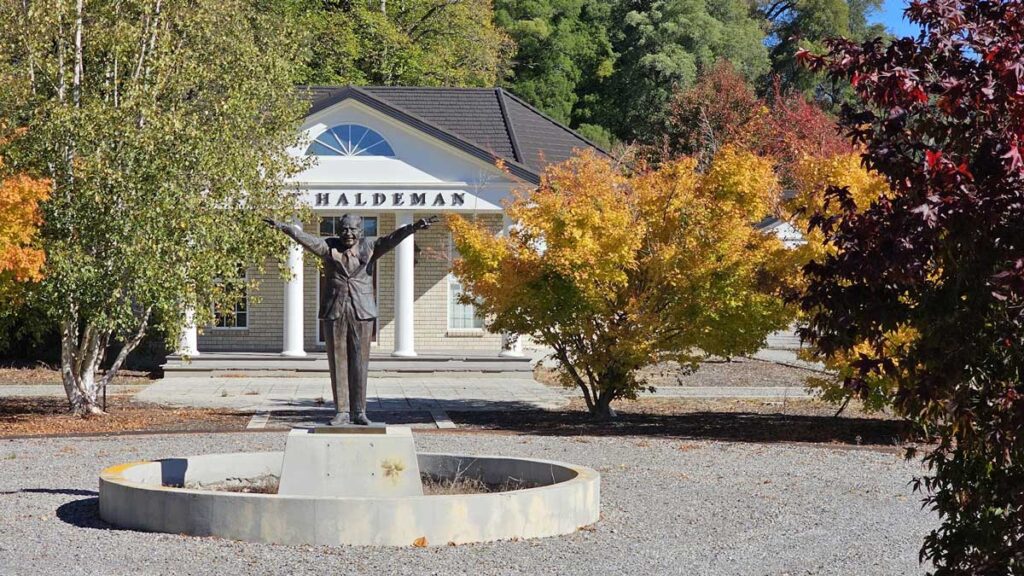
Between the pub and Faulkners bush sits ‘Fort Haldeman’, this eyesore of a place ‘modelled on the white house’. We all know what Nixon’s known for, and there he is. It was a publishing house or something, it is unclear. The fella who ran it has a website, and here’s a Stuff article. Make of it what you will – I make it as a flaunting middle finger to society and decency, squatting in the middle of a lovely little town between a community amenity and bush donated by those who gave it to make the community better. The very existence of this garish turd of a building and its surrounds, ruining the possibility of where it is, must be the biggest thorn in Wakefield’s side, such a shame and a daily reminder and testament to humanities worst. But maybe I’m way off. Interesting, anyway.
We go to Wakefield Bakery for lunch. This is the best bakery. You can tell because it has a steady stream of tradies and locals.
Some kids you just know will be trouble gasbag with us over lunch, while other dodgy looking kids from the bike park mooch about oogling the bikes. Later I notice my bike computer has disappeared. Now, of course one cannot prove it, and perhaps it just fell off; but it didn’t fall off during the entire Tour Aotearoa, or ever since, so one does wonder. It was my bike’s odometer, I wish I had checked the total distance I’ve ridden on the bike before some dick kid stole something useless to them. Or maybe it fell off! Nevermind, such is life.
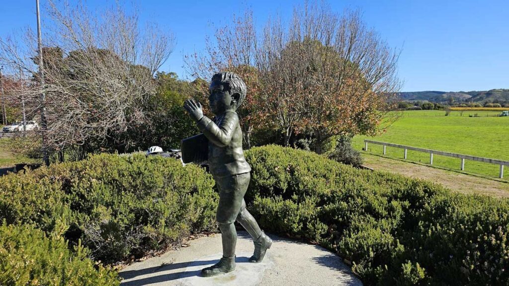
Down the road at Brightwater, we go check out the Lord Ernest Rutherford Memorial. Rutherford’s childhood home was on the site of the memorial, and he spent the first 22 years of his life around the region. He was a proper boffin. One could see the inspiration of the Rutherford memorial as the complete antithesis of the eyesore up the road in Wakefield.
I don’t envy the sculptors’ brief; ‘do a kid of this man’. Stuck between generic young boy or recognisable distinguished scientist, he stuck a mans head on a boy.
We continue on down the Waimea Riverside a while before a grand bridge. We turn into the valley and pass vinyards along the old rail corridor heading into Richmond. We’re all ready for a beer.
It’s about 3pm and the guys are startled by Richmond’s traffic at the Queen Street intersection. Juxtaposed with the last three days, the sound and noise and gridlock is quite a shocker. But being on bikes we toddle on by eventually, heading up to McCashin’s Brewery for a beer to cap off our great taste tour.
What a great ride!
General thoughts
This ride is awesome. It is varied and well-supported, with good signage making things easy. The riding is pretty easy – there’s a bit of adventure if you’re into it but you can also doddle along as a terrible cyclist just fine; particularly if you have an eBike.
I finish it just very happy to have enjoyed it with my pals. To explore this beautiful area I now live in and find places to take my boy as he grows. To find a local great trail I’d recommend to anybody keen on a bike trip.
I thank all those who’ve been involved in designing and implementing this ride. It’s a banger, and you can see in the places we stopped how the bike touring is a local economy winner. All along the route there’s little deviations and shops and art and accomodations and all sorts.
We did think the online information could use work, as could the map pamphlet. I only just discover now that there’s an app, so maybe that would have covered quite a lot of what we found wanting. But we thought the elevation profiles should all be the same way around, the numbered map markers were pointlessly complex, and a little more attention to riding the entire thing could have been done rather than the hard focus on ‘4 bits’.
Amenity/attraction-wise, Day 2 (Motueka to Baton/Tapawera) is a bit sparse. Ludlow’s Leap is an absolute gem; but still some kind of something wouldn’t go amiss along Motueka River West Bank road. Perhaps the Pokororo Hall and swing-bridge area could be something.
I highly rate and recommend this trail! A blast; particularly with great pals.

Great taste trail ridden 22-24 April 2024.
Leave a Reply