
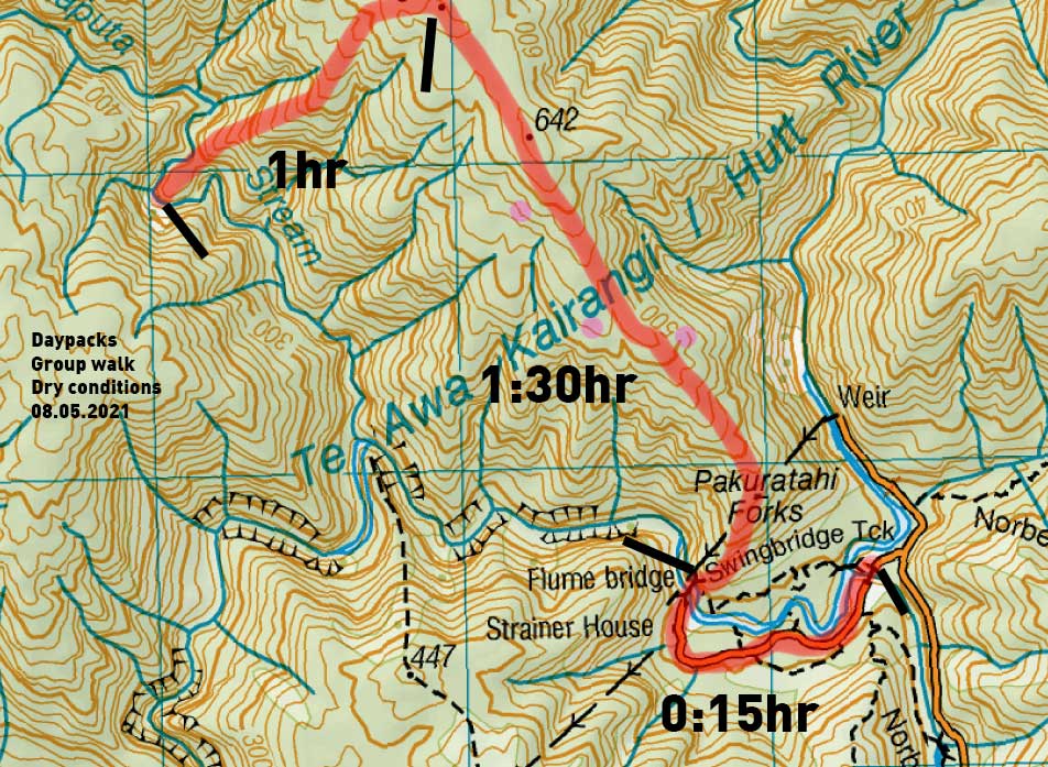
A small group of Meetup trampers met to find the A-frame shelter on the Putaputa stream that feeds the Hutt River. Given there’s not much out there about this, thought I’d share our timing without giving too much away!
Carpooling from the city, we meet up at the Rivendell carpark – and find the swingbridge track is closed, as the swingbridge isn’t there! The GWRC is replacing the bridge with something more accessible. So we go around the long way, to the Flume bridge.
This area of the Tararua Forest Park is a wilderness area; there are no track markers and the decent thing is to keep it that way. We follow a fair ground trail up to the ridge, then wander long past point 642, to 641, then in the saddle between 641 and 638, we start heading south west.
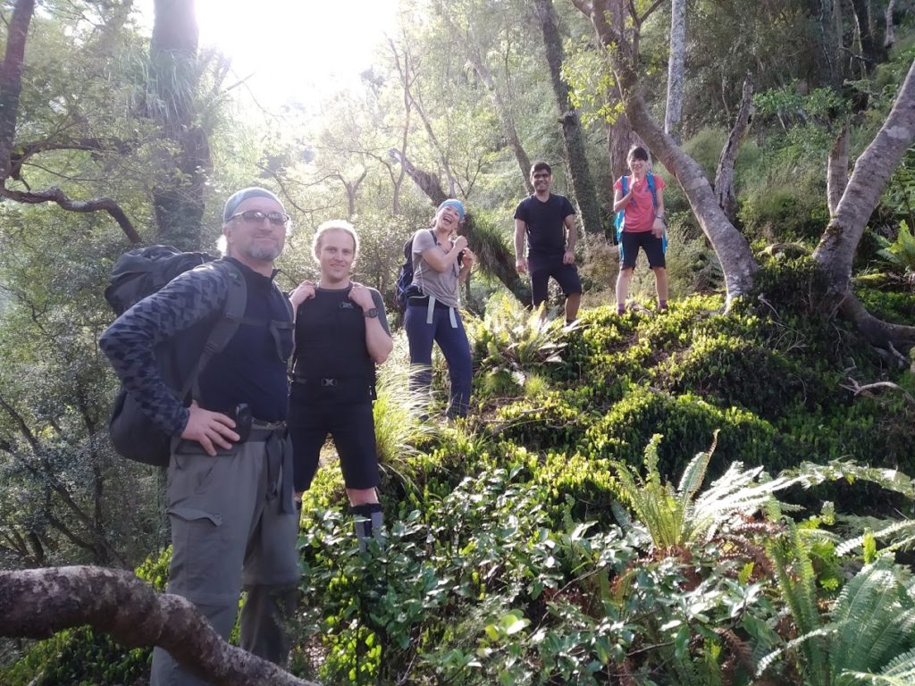
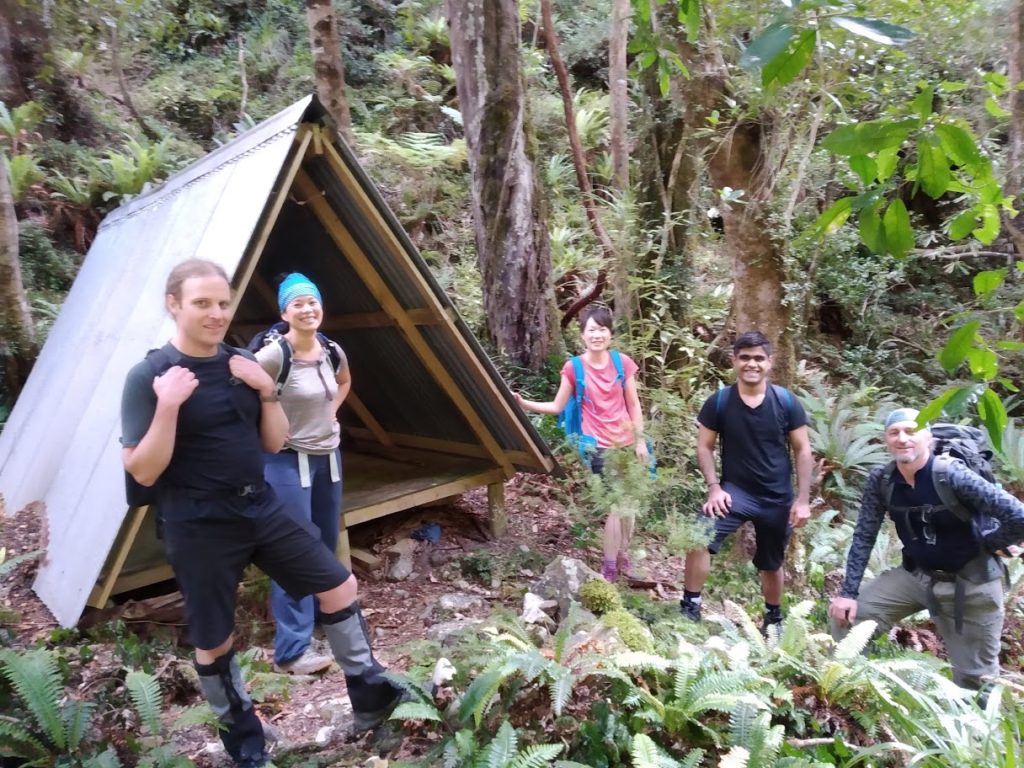
We follow various goat trails but keep on the correct spur, and drop on down. Near the bottom we come off the ridge a little, and are very much rock-scrambling across very steep drops which is not much fun, but the team are up for it and we spot the A-frame next to the steam below us.
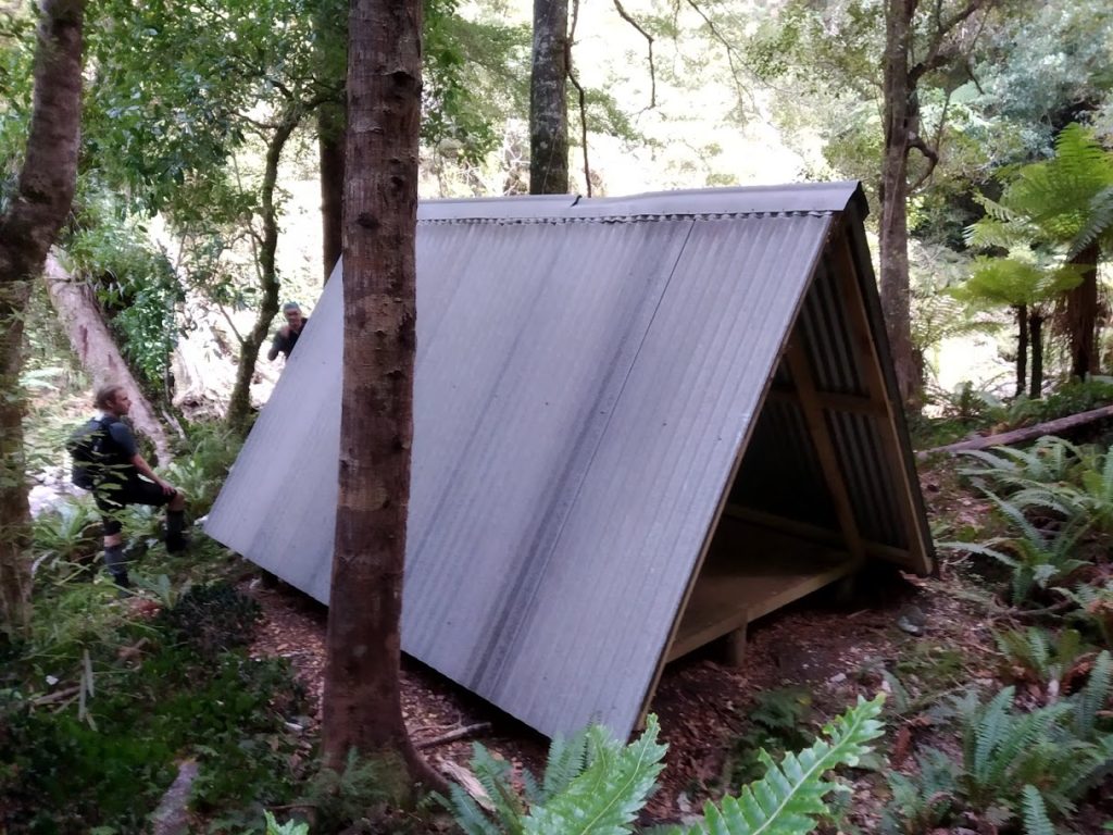
It is in surprisingly good condition. A pile of leaves is building up on one side which are rusting the iron, otherwise it looks mint! No idea when it was built, but you could sleep like 8 in there. An old DOC leaflet about the evils of giardia is all the information at the shelter.
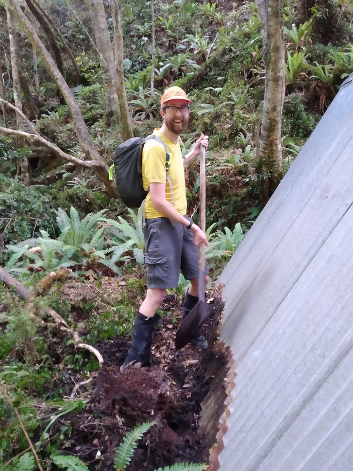
There’s a shovel, so I move the leaves away from the iron to help prevent further rusting. We should always do our bit to keep backcountry shelters in good knick when you’re passing through!
Over an early lunch we muse about departing via the creek. It looks low enough to be passable, but I opt us for the ridge again as I don’t feel like risking us getting stuck – stick with the sure thing on a mid-winter daytrip!
Climbing back to the ridge is much easier, and then we’re heading back down. I figure it’ll be a peice of cake to keep the ground trail, but we lose it three times and head off down other spurs before correcting. I have marked these on the map in purple.
I use the GPS on my phone for this trip, but I think a full loop of this in summer, coming down the ridge, just using map and compass, would be a quite fun navigational test!
Great little adventurous daytrip taking 3hrs in, 3hrs back (including our 20 minute Flume bridge detour and a nice lunch break).
Times for the walk in the pic.
Leave a Reply