- Date: 24/03/2018 – 25/03/2018
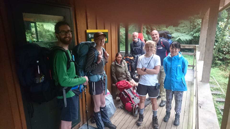
- Party: Larry & 7 respectfully anonymous folks (3 with the initial ‘M’!)
- Night location/s: Haurangi Hut
We depart Sunny Grove at 9:30am, shrouded in perpetual shade. We are a party of eight, connected through the Wellington Tramping Group on Meetup. Our destination is Haurangi Hut, a 10 bunk DOC hut available by booking only. M booked it 9 months earlier. The weather was a dice roll – we stroll through the drizzle.
Minutes in, we pause at the split between a 4×4 and foot track for a map check. “Practicing those navigation skills?” I ask; M and I attended an OTNZ navigation course together last week.
“Yes, I attended an OTNZ navigation course last week” he replies. I am glad I left an impression.
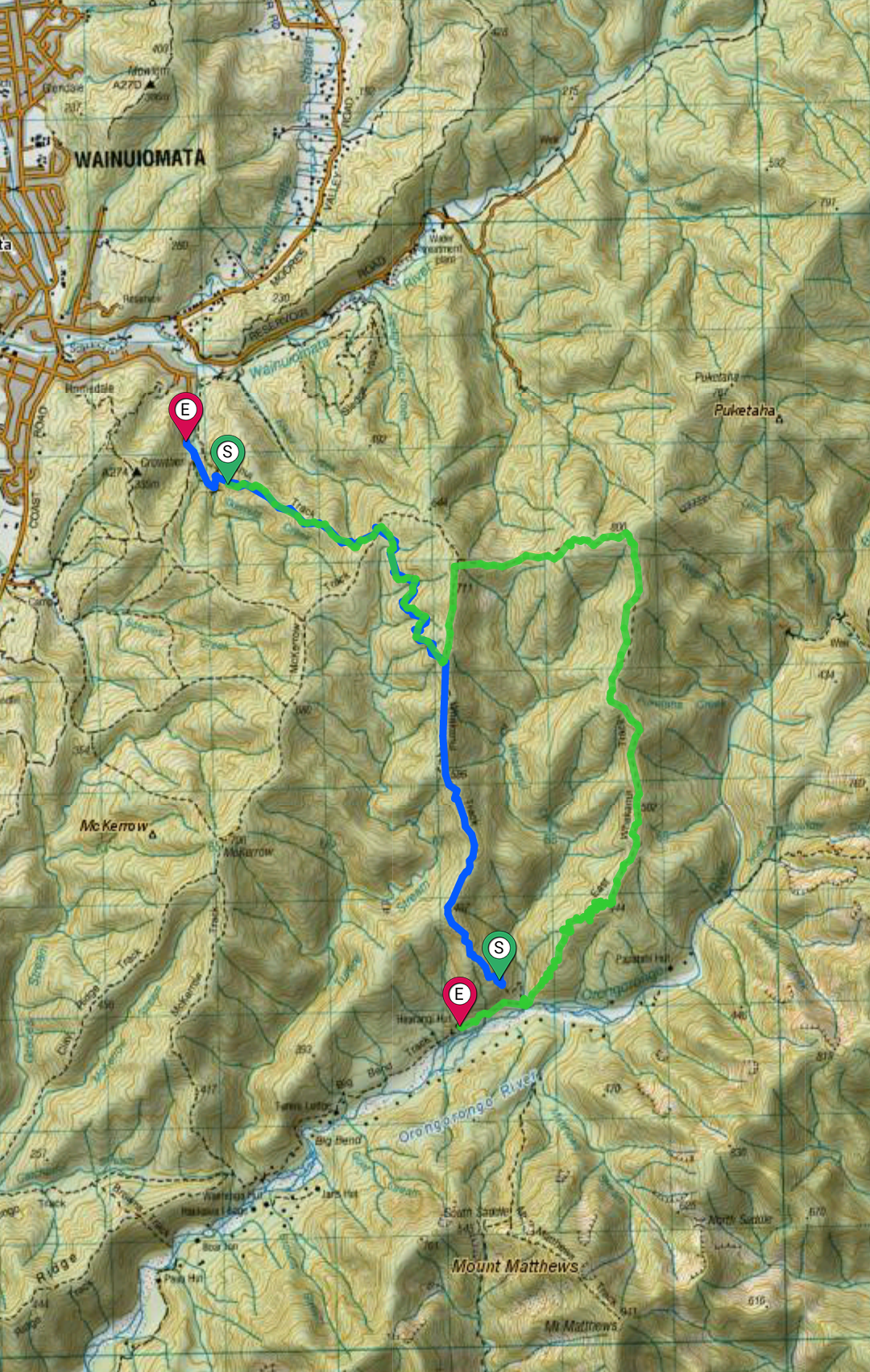
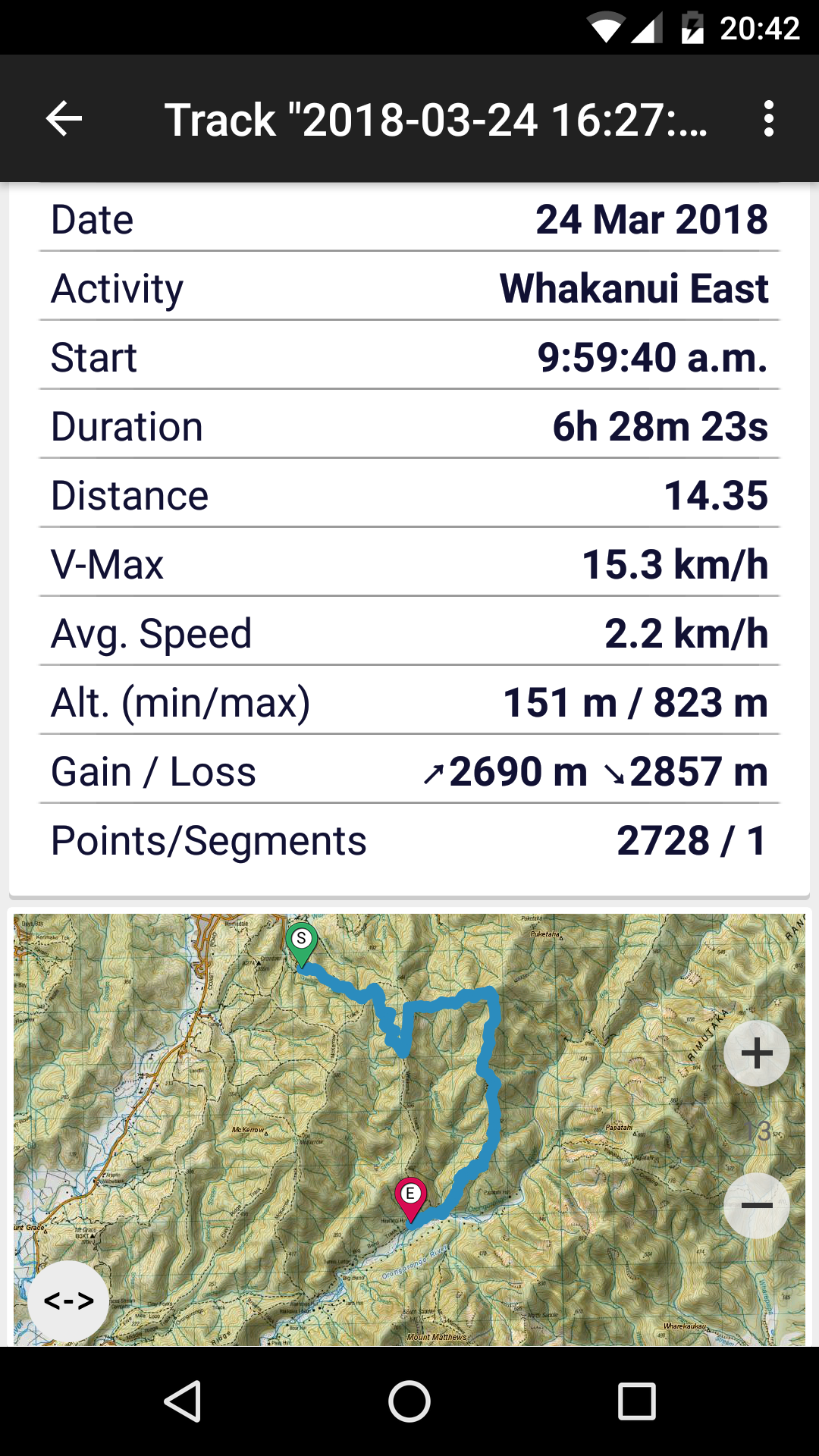
As with Dave and M earlier, Whakanui track begins with a steep but well graded climb, crossing Skerrets Creek and passing the Game of Thrones pine tree, climbing from 120 to 540metres in 1.5km.
At the fork to McKerrow track (540m) we convene. Some want to walk the harder Eastern Whakanui Track; others the regular Whakanui. Six take the East, with Y and M taking the more direct route.
The tracks are aggressively well-marked, and the map tells us the turn is shortly after the fork. We all walk right by it. Fortunately M and I both are using GPS apps (my first time) and it is very helpful in discovering the other turn some time south. (NZ Topo App is the biz, btw. Pro version $15 for caching maps).
At the track intersection (640m) we regroup. We encounter a party of three, leaving their night at Haurangi Hut. M raids their carried garbage for worthy cause, but it makes me uncomfortable. If anyone asks ‘can I go through your rubbish?’ I would say ‘no’. I buy shameful things.
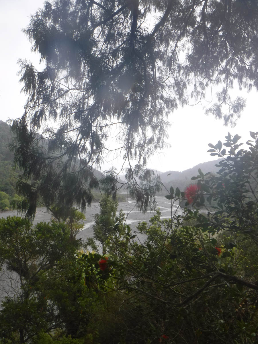
The eastern route is marked only by blue trap markers; it is not a DOC maintained track. They have actively suggested noone use it. It’s roughness is endearing, the ground soft, I enjoy it more than any other in the Orongos so far.

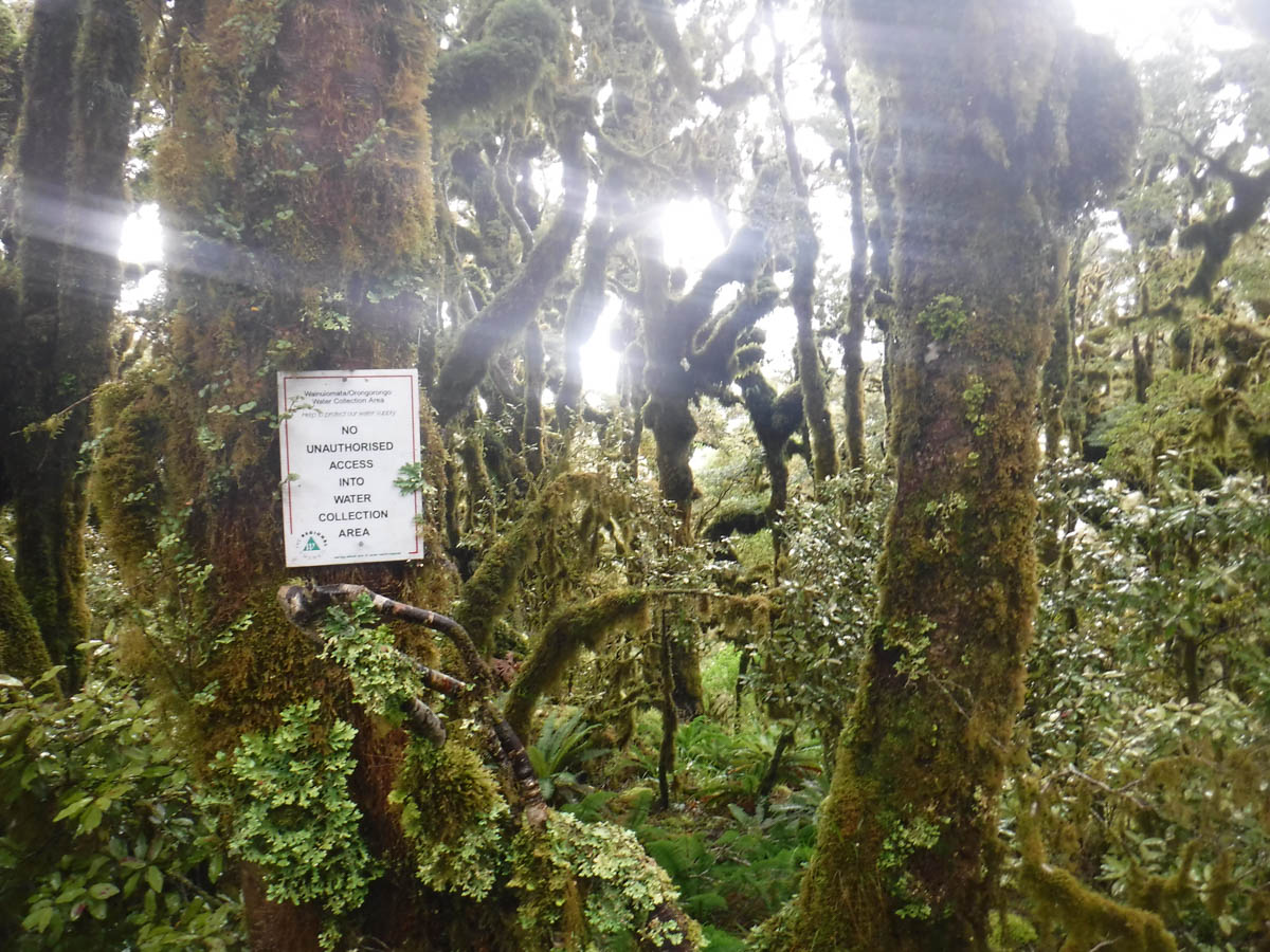
We climb back north beyond the 711 summit, and to the meek fork at 720 – weirdly not marked (12:15pm). We naturally split into 2 parties, dropping 100m into a saddle, and climbing 200m up the other to the 800m summit for lunch (1pm, 3.5hrs from roadend). Here we are warned about entering the Wainui water catchment area beyond; I assume this is why the track is no longer on the beaten path.
We eat lunch. M rejects my proffered tramping detritus.
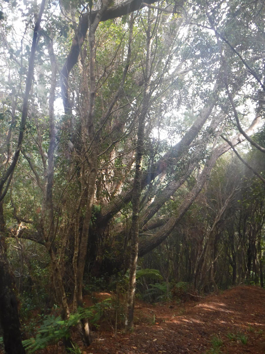
We head southbound and down. It’s a wonderful track, past massive Rata, through fern and less travelled; our legs are slashed and sodden by the encroaching vegetation. There are a few clear patches along the higher ridge; how the altitude decides the vegetation is plain to see. We lose the track occasionally, but find it quickly thereafter; you just follow the main ridge south.
At one point we cross a massive fallen Rata. Skirting it, the blue markers just stop. Which way do we go? We split up and investigate.
I discover a blue marker beyond the fallen tree; ‘it’s over here’ I announce. I’m proud of myself. Check me out, I know what I’m doing. “I think we came from here” M tells me. I consult the map, and my compass. We should be heading south, but the direction I think we should go shows north on the compass. I decide the compass must be wrong. ‘Maybe the magnetic field has reversed’ I consider. Shamefully the instruments are correct and we discover the route heading south eventually. Those stories of bush idiocy? I have always read those so smugly. ‘What idiots’. So glad I had the gang to correct my assumption. I know to trust your instruments over your stupid brain, and yet, there we go.
After some km of dry, flat ridge-walking the final bit of the track is a dead-drop to the river (just 25metres or so). We reach the Orongorongo at 4:10, about 7hrs since we left Sunny Grove and 3 from the 800 summit.
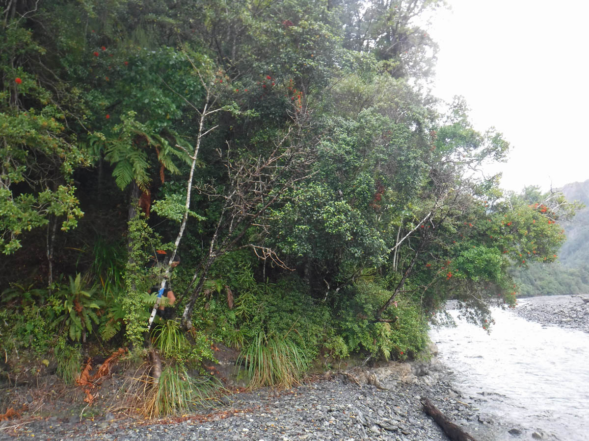
Following a quick skip over the Whakanui creek with wet feet optional we’re at Haurangi hut (10 min), twenty minutes after Y and M were to send out a search party. They’re in a right flap, leisurely having a cuppa.

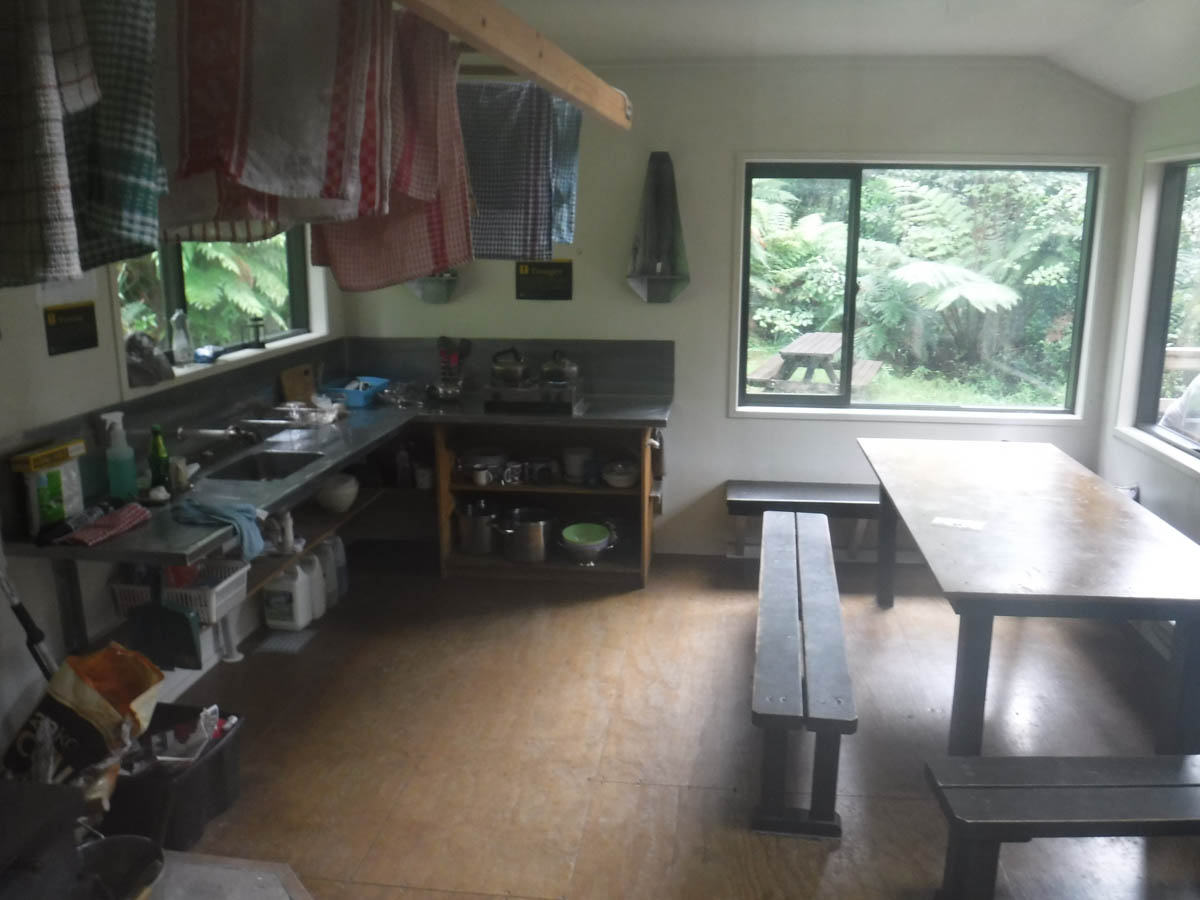
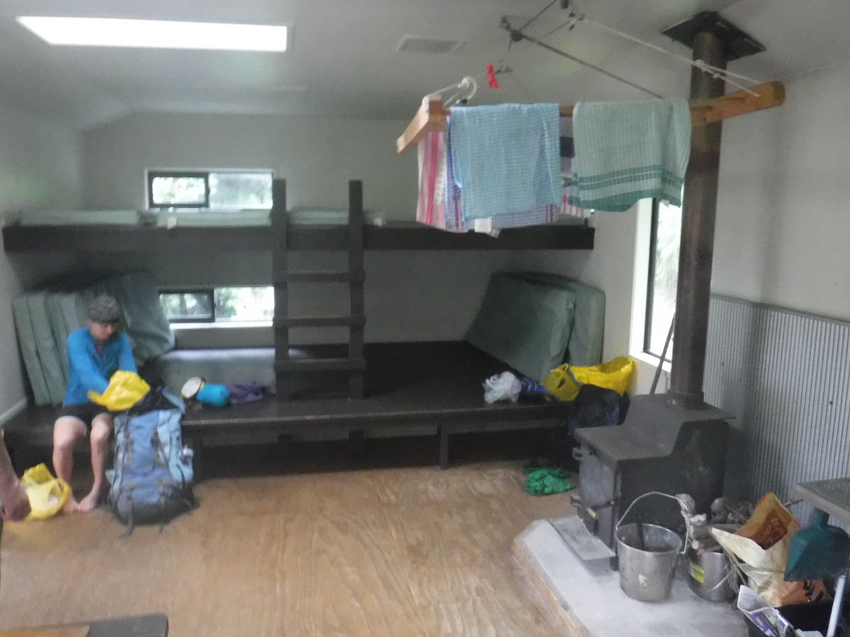
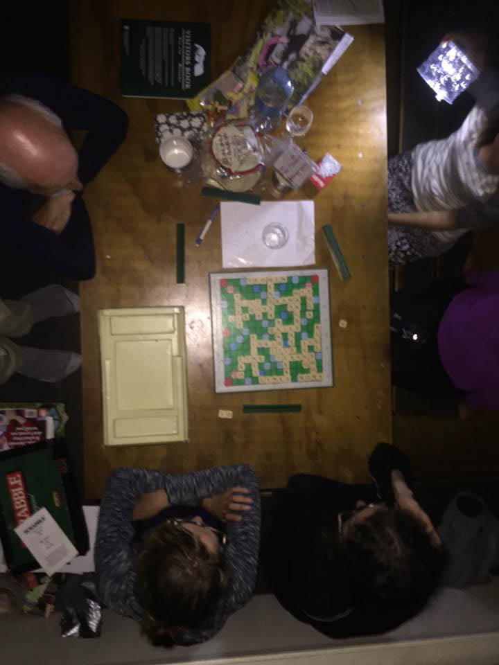
Tea is drunk, dinner prepared, games played and a good night had by all. Being a rented hut, there are luxuries; DOC-supplied gas, real cutlery, dishes and scrabble. We add to the culture where relevant.

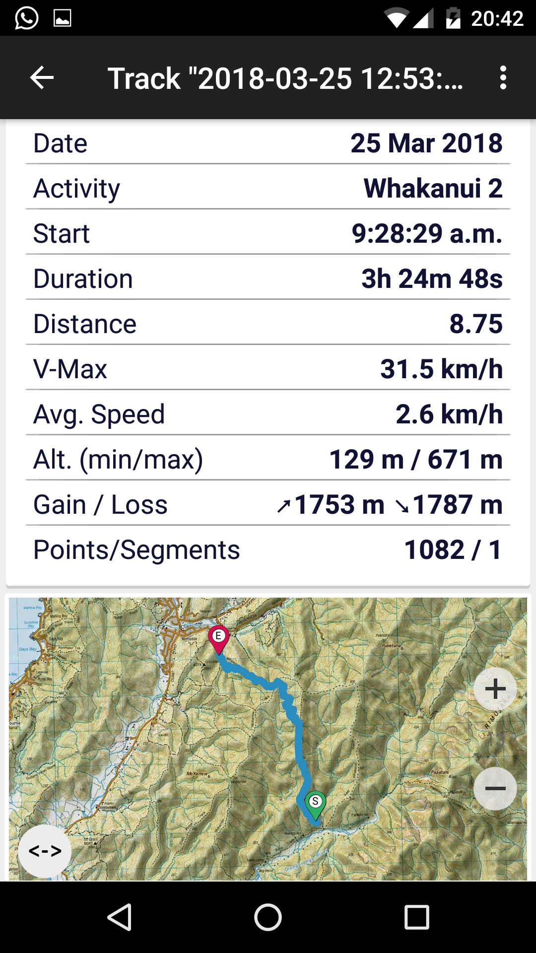
Rising around 7, we head off just before 9am. We reach the Whakanui creek at 9:10 and prang it on up the hill to the the McKerrow turnoff at 12 (3hrs). Knowing to just look for blue markers and a tiny wee track, we spot the turn we missed. Victory!

We get out about 1 and visit the Seashore Cabaret cafe in Petone for lunch, where we proceed to eat their whole chocolate cake. A nice end to a great wee trip!
Hi Larry, great review, thanks for the post.
Is the Whakanui track (not the Whakanui east track) well marked?
Would you need to have GPS and a compass to navigate, or would you be able to follow the trail?
Thanks!
Thanks Elyse. The main track is obvious yep, or was in 2018! I’d strongly suggest chucking a topo map app on your phone regardless e.g. this one is $6. https://churnewzealand.com/best-topo-map-app-nz/ Give yourself peace of mind you know where you are for all your adventures for the price of a coffee. Hope you have a good wander
Thanks Larry – will check out that map app!