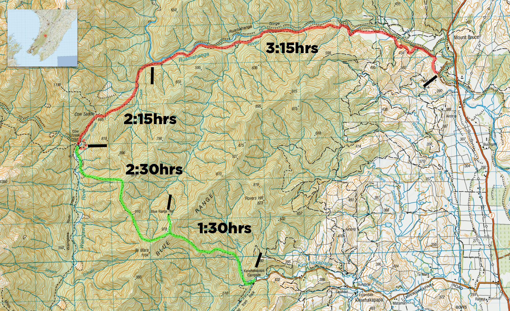
Only after I began peeing over the fence did I notice the periodic zap of the electric line mere inches from the action. We’re at the farm carpark where the Ruamahanga river meets State Highway 2, a bit below Mt Bruce. We miss the road in the first time, as it looks like a driveway.
I only stalled R’s manual car once parking it up (to much of my groups fanfare) – R and I swapped cars in Masterton – this is our first car-swap trip.
My Meetup tramping group is:
- C, a fit chap from the US
- J, C’s mate, also very fit
- K, a seasoned tramper recently moved from Auckland
- Me
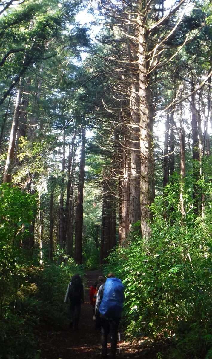
We forge out at 10:25, heading west over farmland. We’re mindful to follow the farmers’ preferred route for trampers but we just cannot find the track. There’s the odd blue marker, the odd orange marker; it’s a bit scattered. We follow either, none or both.

Following a blue marker some distance into the farm, we drop down a rough-hewn route that drops to the riverside. I am given shit for my leadership, and we clamber up a nearby slip to regain the road we left.
‘This tree is rotten – should I push it down?’ asks J.
‘Can you wait until we’re not below it?’ asks K.
He does.
Back at the top of the cliff, we scramble past a cross and thankfully rediscover an orange DOC-marked route.
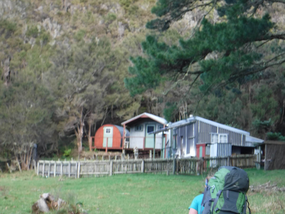
We pass a patch of really neat private huts and carry on along an old road, now covered with moss and manuka.

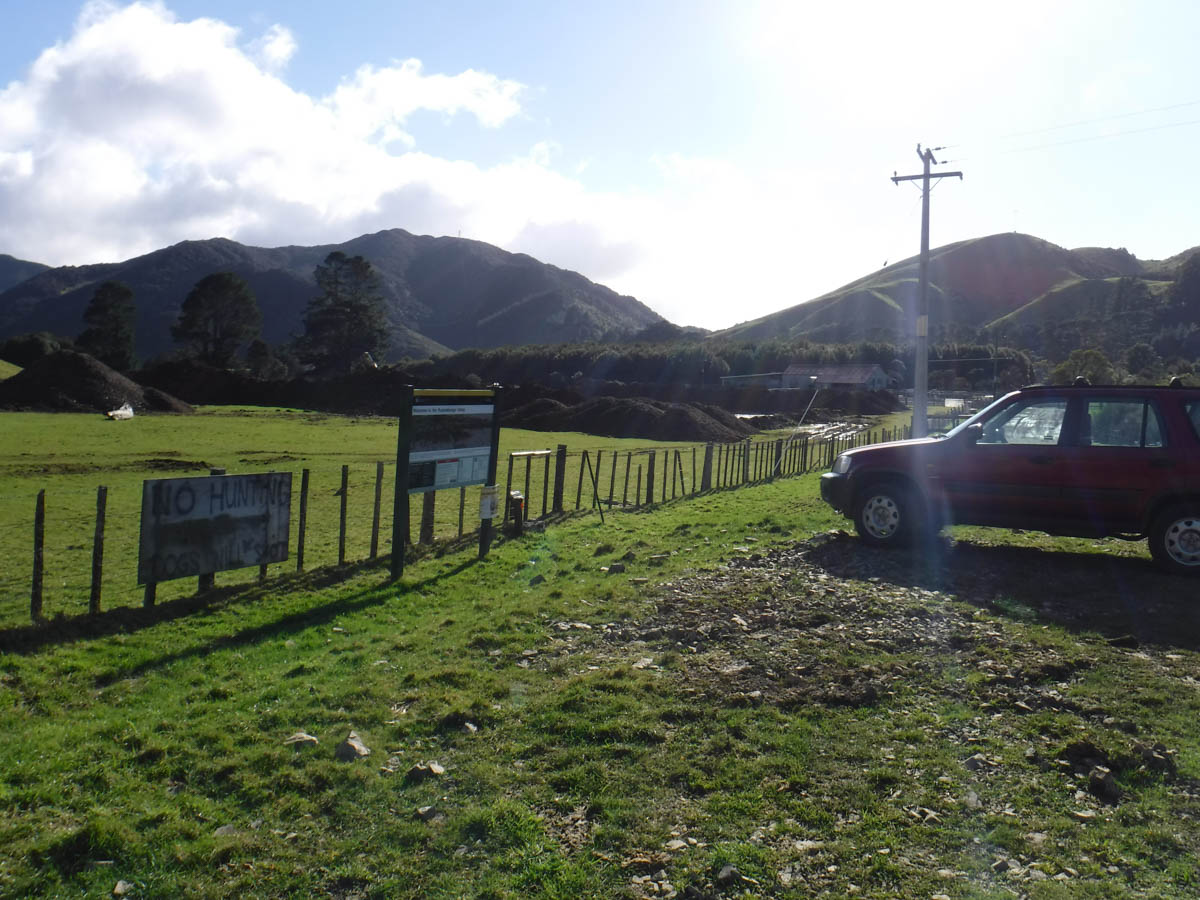
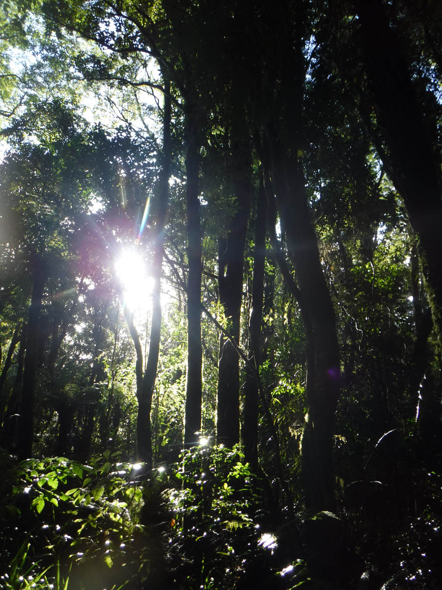
At 12 (1hr 30 of farmland) we reach a sign showing we’re now in the Tararua Forest Park. It’s instantly beautiful; great trees, vines, all the good stuff. There’s a nice camping spot not far in.
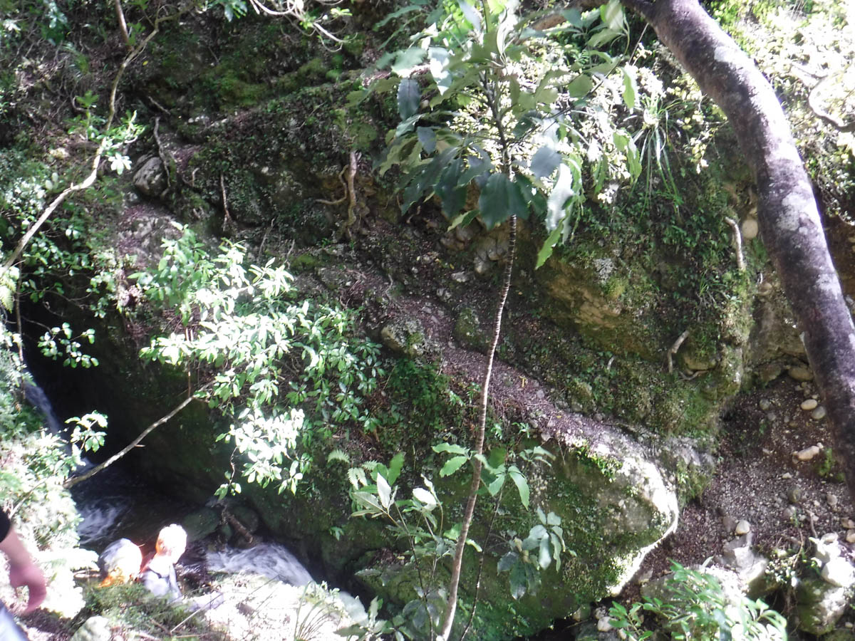
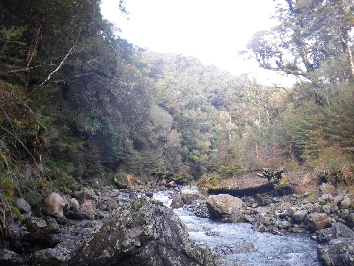
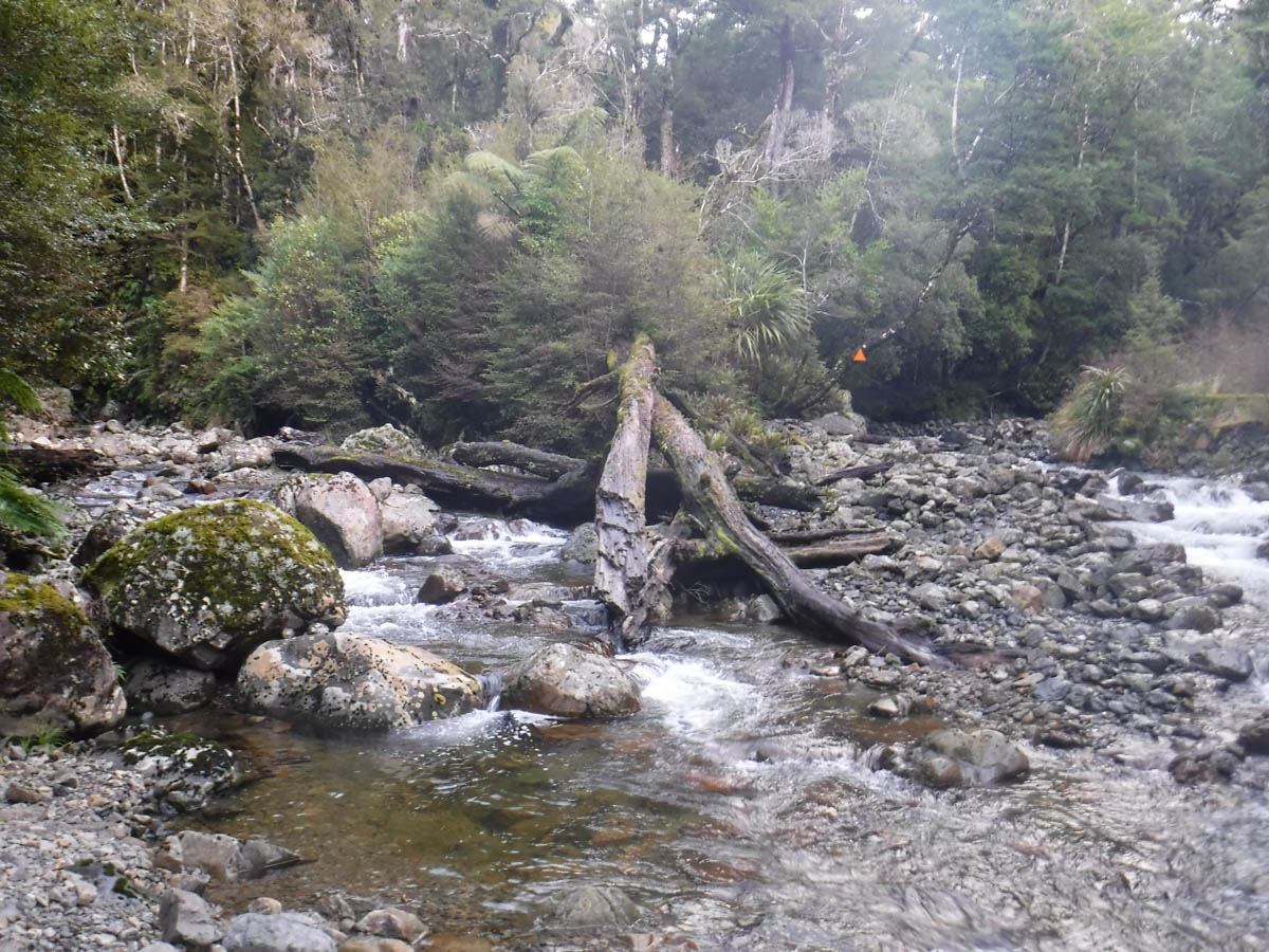
At 12:15 we cross a creek which carves through great square boulders. A zig-zag route has been cut into the face of it – all ‘infrastructure’ of a deer-and-goat-culling age I suspect. It looks more gnarly than it is, but it’s a bit of excitement; this whole Ruamahanga route is pitted with occasional adventurous moments. It’s a muddy route, made more enjoyable by J’s long-jumping mud-avoidance efforts. I will him to leap into a great pit of mud but he’s just too good.
At 12:50 (2.5hrs from roadend) we reach the biggest worry I had, the huge tributary stream. It’s low enough for K and I to keep our feet dry dashing across the water. Unfortunately K had given J and C heaps of shit about dry boots, and they had committed to keeping dry boots. So dry boots they will keep, and they spent some time finding a spot to leap across the flow. K and I watched on, somewhat unkindly hoping for a drenching, but to no avail – J and C are fleet of foot. They’re quicker to the track than us in the end.

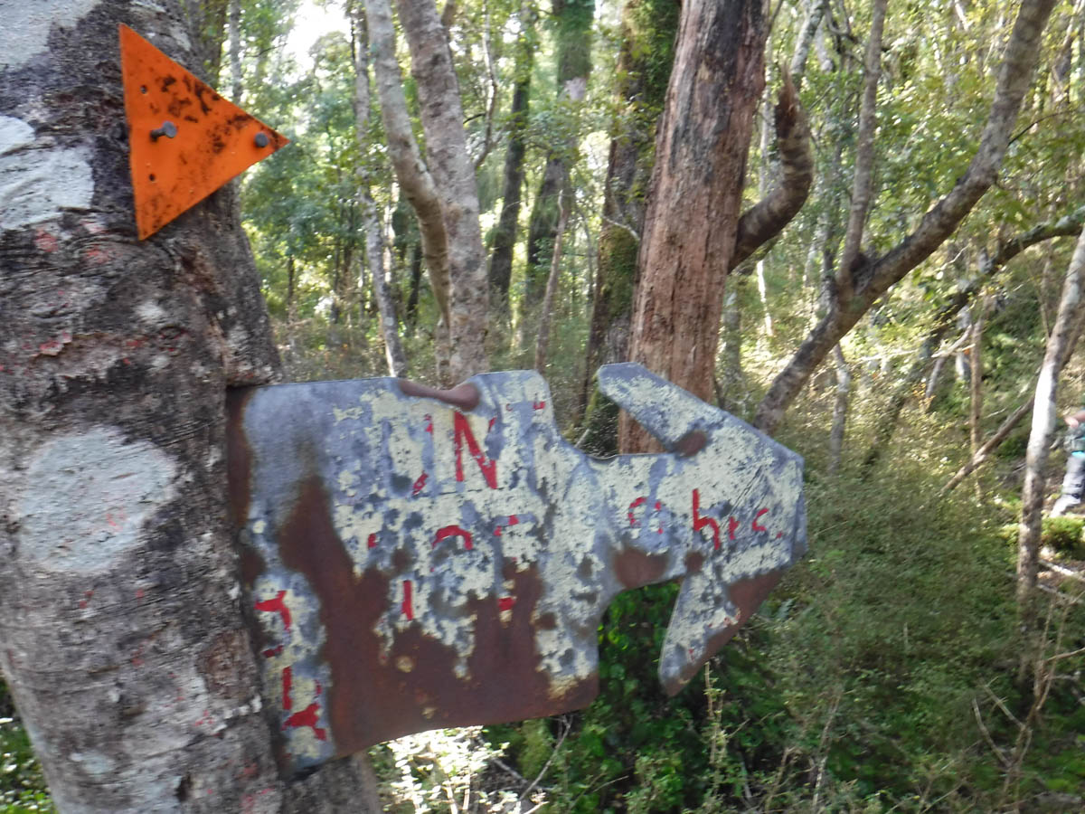
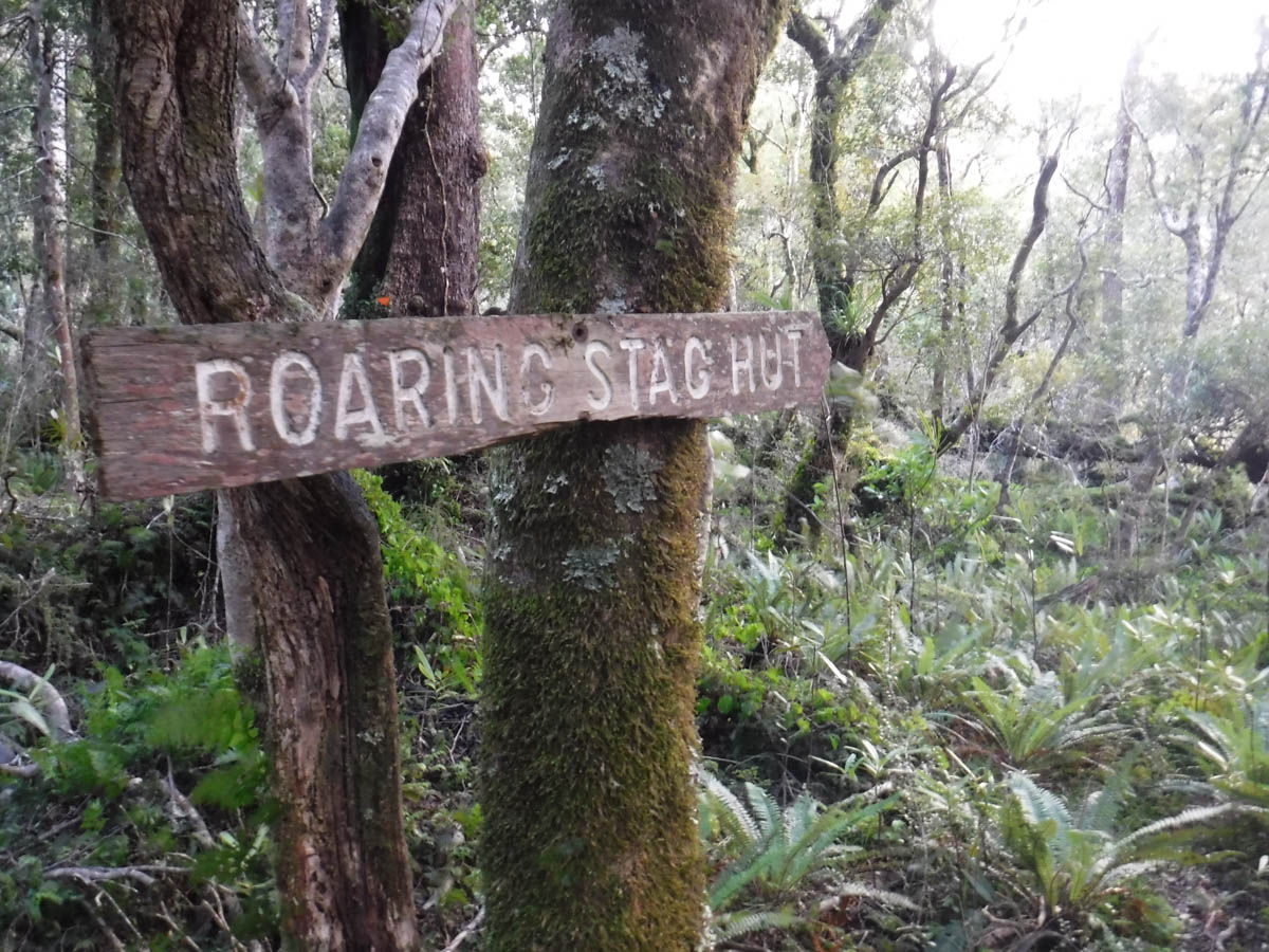
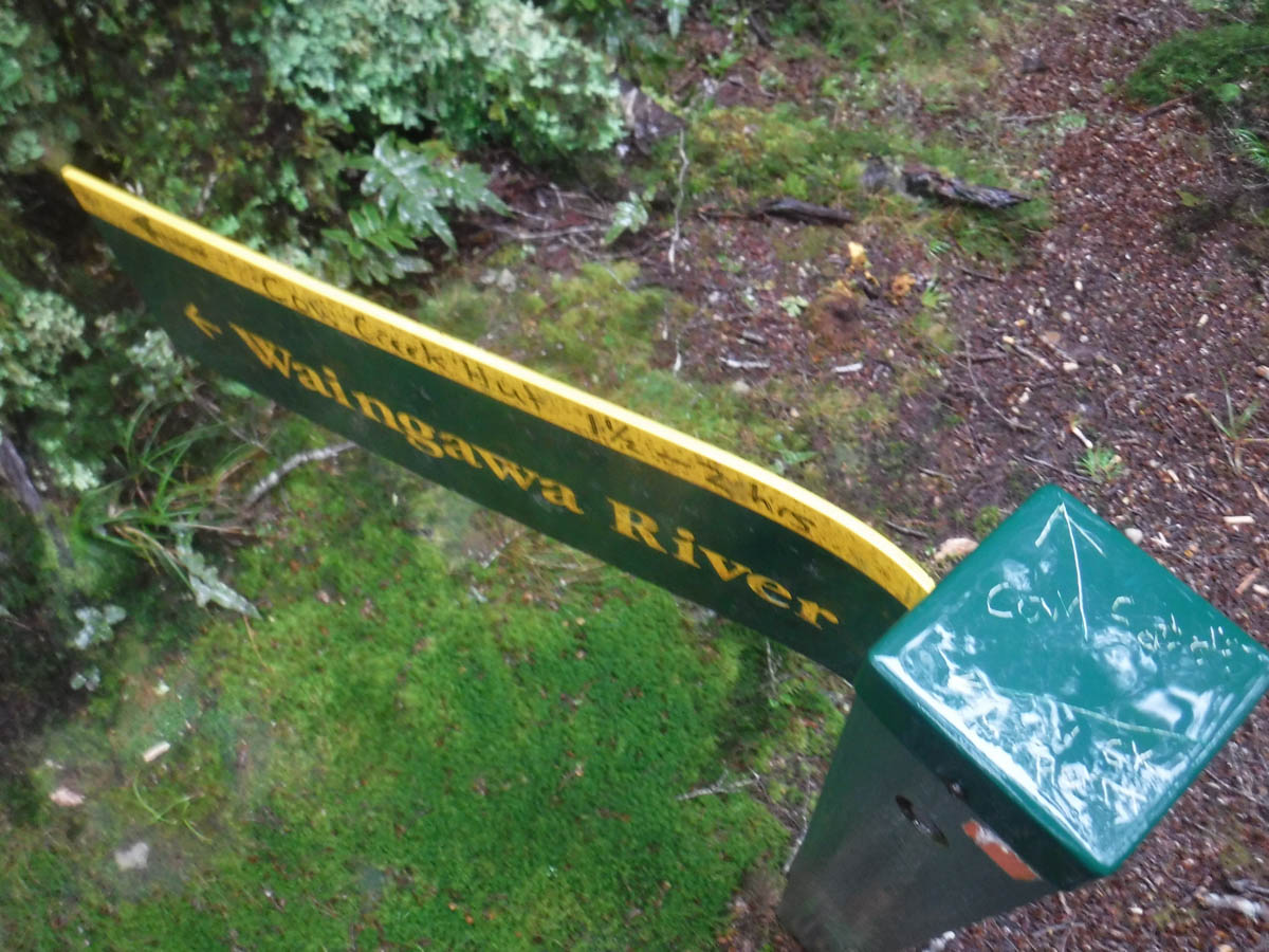
At 1:45 (3hrs) we cross an old sign marking the turn north for Roaring Stag hut. Nearby are the old signs for Cow Creek and the road-end. The track is well marked.

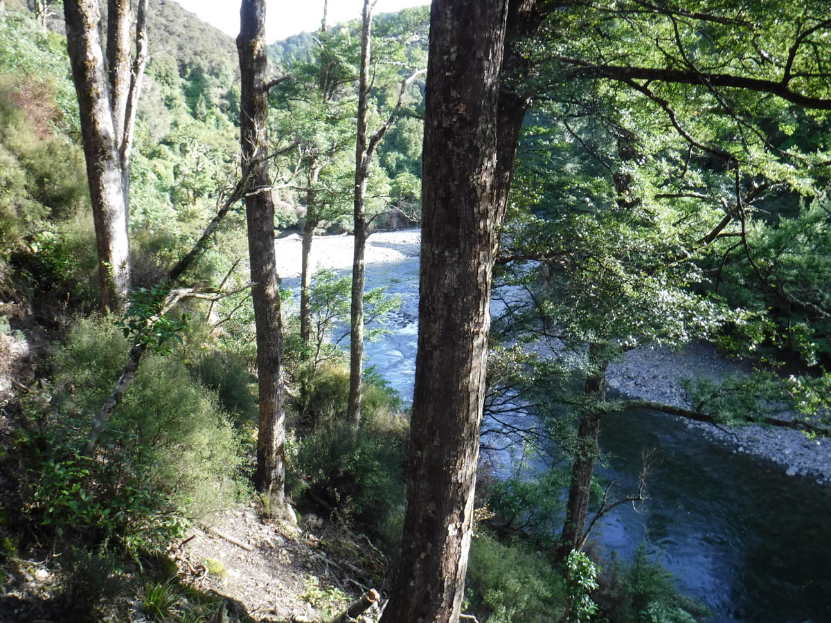
2:15 sees us meeting Cleft Creek, which is a bigger catchment than the map may suggest. The track is quite well marked with the giant DOC triangles for getting on and off the stream – there’s a stretch of 50 metres or so along the creek before you climb back up the true left. The Americans and I took different bush-bash routes to avoid the deepest patches; K made use of her boots’ drainage holes and bombed on through.
At 2:20 we’re at the 2nd fork of Cleft Creek, ready to begin our climb for the day. It’s about a 300metre climb, but I find it a real shit. It’s only about 3pm I realise I haven’t had lunch; I didn’t stop to put my watch on. ‘We’re a bit passed lunch now mate’ K tells me; I shovel a snickers in and plod along at the back, slowly. As for J and C – if you mentally envisage a young tough US marine type, shovelling sausage after sausage into the war machine, there you go. They’re climbing monsters. And K’s miles ahead of me and I’m not even that unfit at the moment. The track is pretty well marked, I’d say in the last 2 years DOC re-marked it – but it’s not a great track, closer to marked at times with a few ‘how will I solve this’ type moments. Nothing of concern though, just fun, harder tramping.

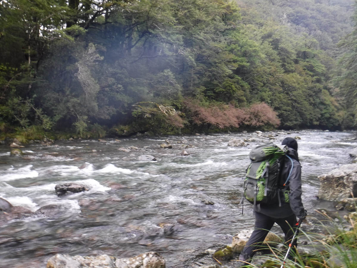
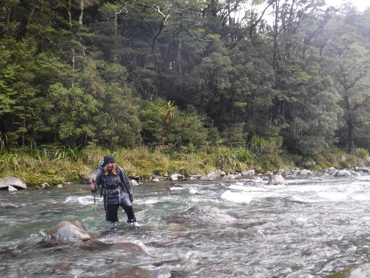
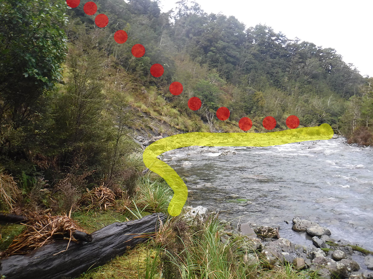
At 3:15 we reach Cow Saddle (5hrs). We inhale some food, put on some warmer gear and begin our descent. At 4pm we reach the Waingawa River. We spy the orange of the hut across the river; but to reach it we must climb 100metres around a slip. K is keen to cross the river. She knows what she’s doing and I need to learn – I agree to give it a hoon. It’s the highest, widest river I’ve ever crossed, climbing halfway up my thighs at its height. But it isn’t all that fast, and using the techniques learnt on my training courses, all I am worried about is wetting my shorts.
We find the other group nursing the fire, having arrived ten minutes earlier. K and I take the last 2 bunks of 6, and our American pals opt for their tent over sleeping on their mats on the hut floor.
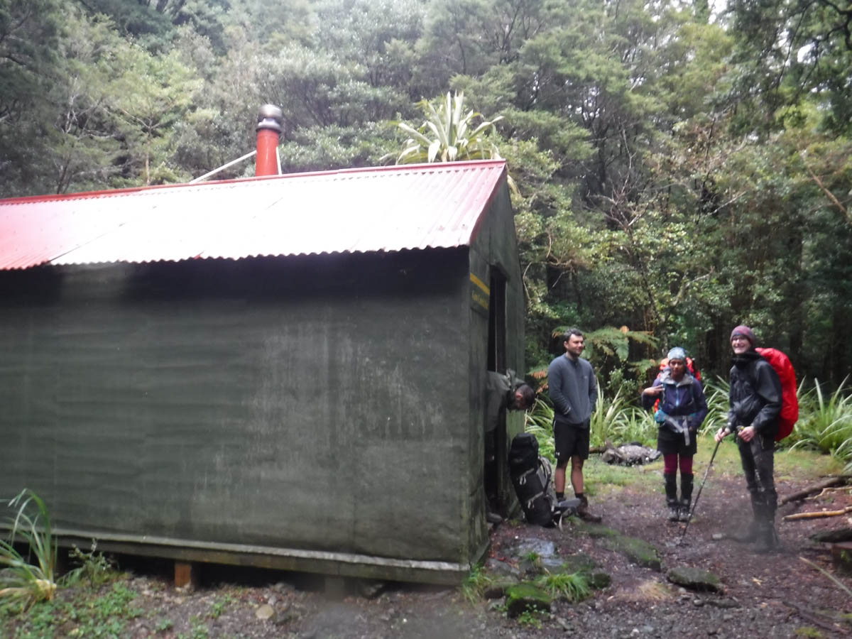
It’s so great to see the other group, who had a much more leisurely day than we – we have a great evening about the fire, retiring about 8:30.
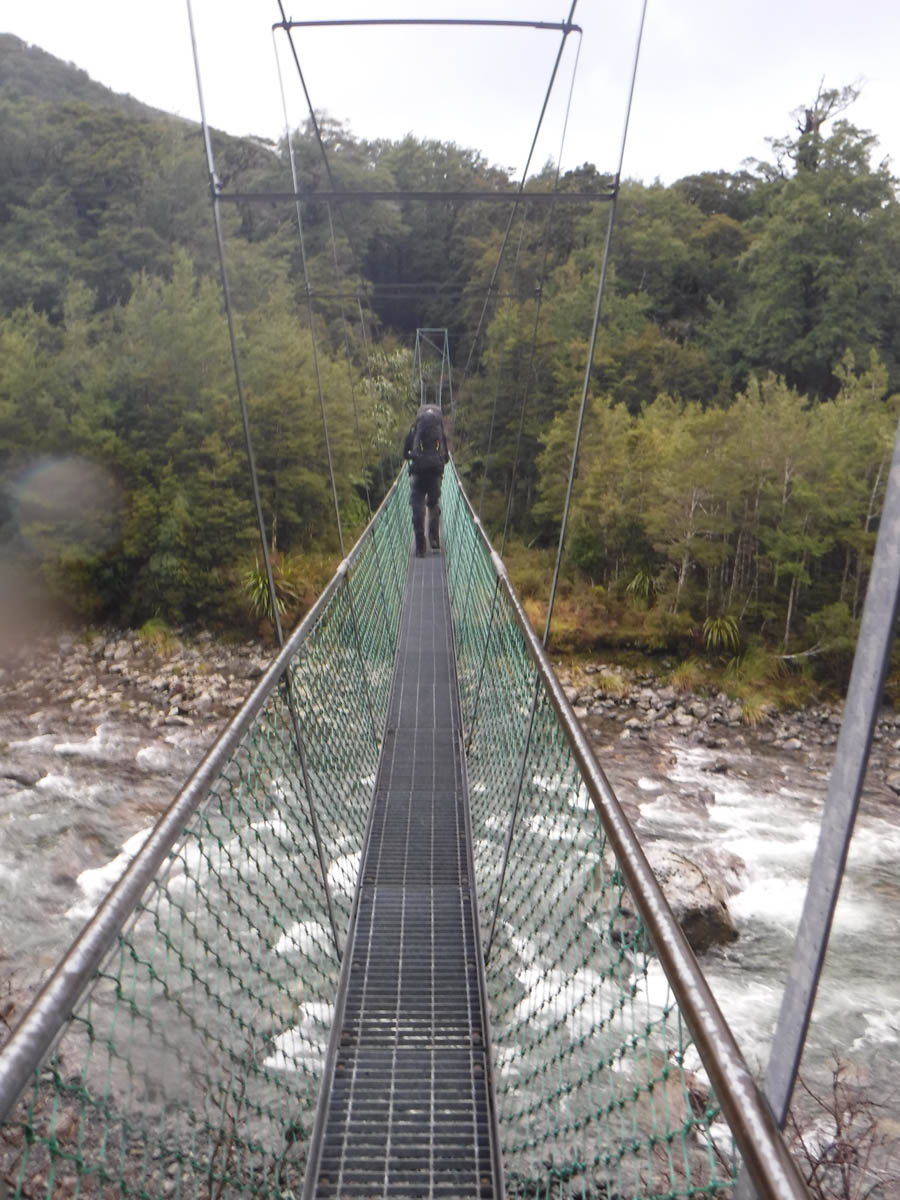
We rise at about 7, leaving about 8:30. While the rain was fairly present overnight the river doesn’t seem much higher – but we’re happy to take the bridge this morning. 10 minutes South-west of the hut, we meet an old big slip. The DOC markers say up, but our research reading says down; we drop to the river and skirt along, bush-bashing a few metres where we could go no further on the river bank to once again meet up with the DOC track.
It’s a 400 metre climb here; it’s a slow slog. J and C go along with my pace today, and I granny-step up the distance. At 9:45 (1:15hrs) we reach the top 250metres south-west of the 970 point. The old track is marked here, to cross over the ridge to Cow Saddle. We continue on.
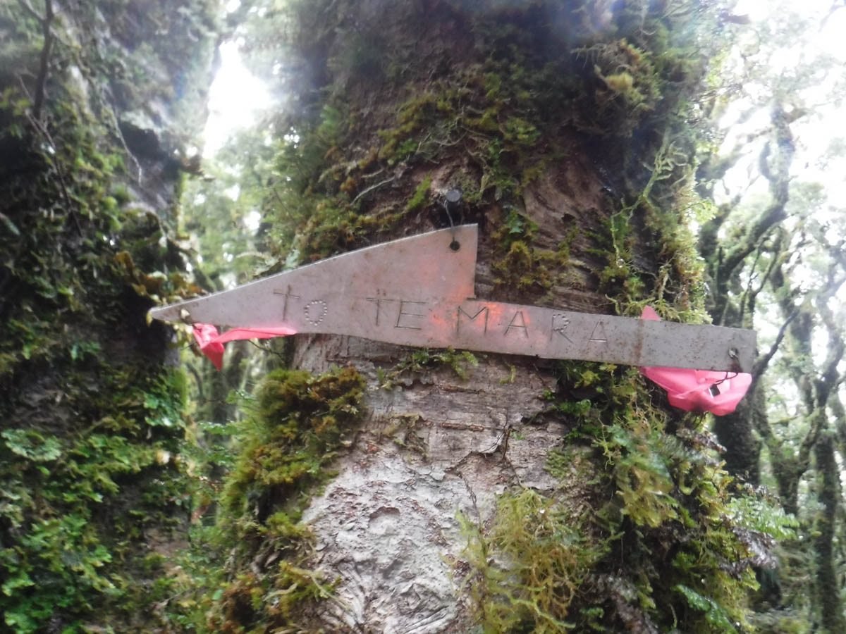
At 10:50 there’s a sign to Te Mara peak. We don’t feel like ticking the box; it’s rainy, windy and cold. We have Blue Range Hut and a hot drink on our minds.
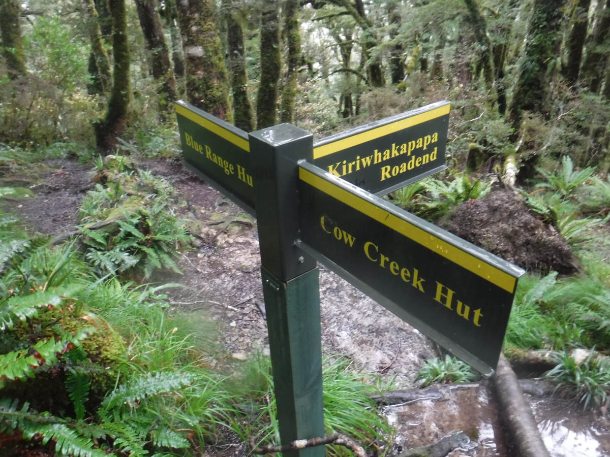
At 10:56 we hit the intersection. Blue Range Hut in 15 minutes. The topo map marks a small section of open tops here – it is not so – all in the bush, albeit much thinner.
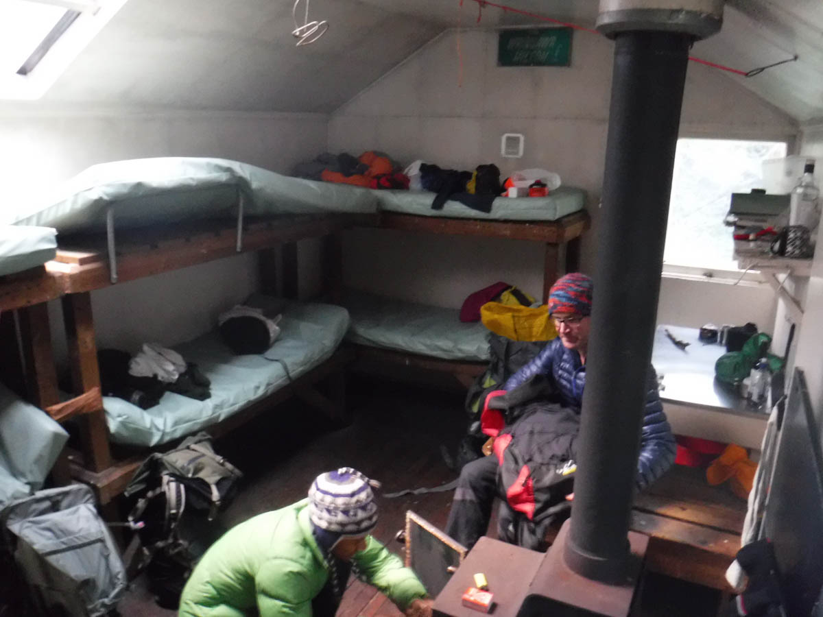
At 11 we’re at Blue Range Hut.
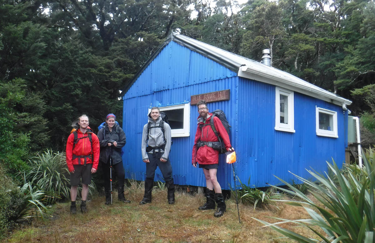
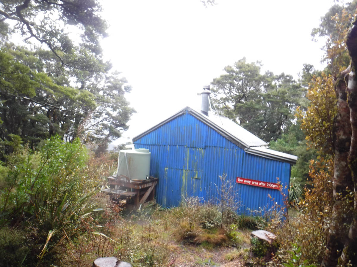
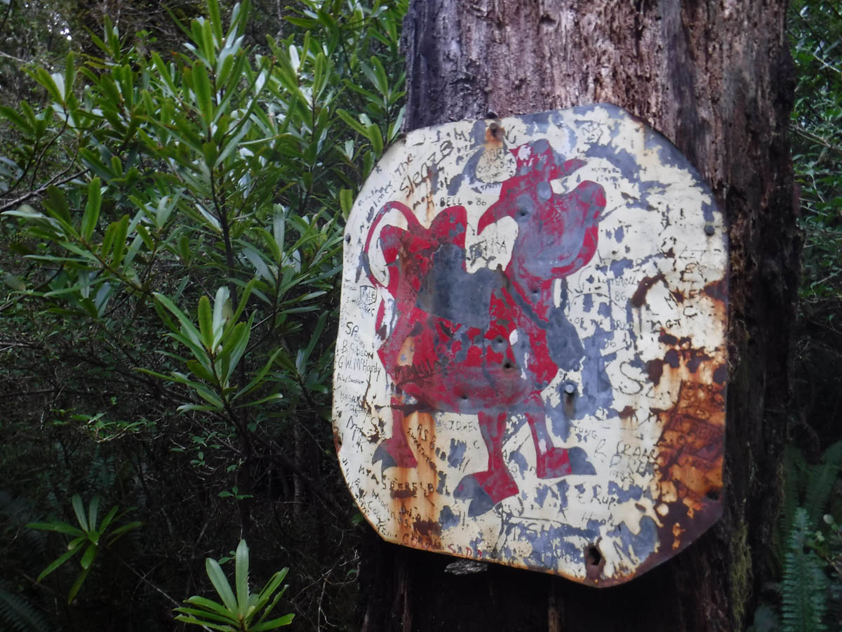
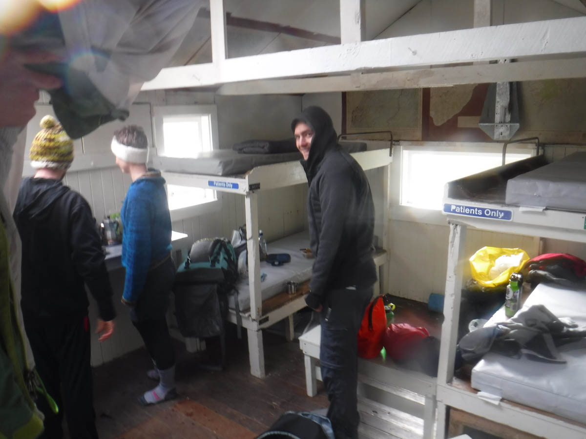
It’s a great wee hut, custom and full of character. Covered in signage from the old Masterton Hospital, the toilet is marked ‘Social Workers Office’. The ceiling is covered in old maps; there’s even a can of Canadian Club in the cupboard.
Inside are a nice couple, having spent the night. They’re happy to see my stove come out, as theirs died this morning. While we eat our lunches, they make use of it and fill every vessel they have with boiled water.
At 12:15 we leave the hut and begin our descent to the Kiriwhakapapa Campsite. It’s a consistent and considerable drop, but much easier than yesterday, with just a bit of sliding about. In the flats near the campsite we see groves of redwood.
We wash our boots in the last stream and are happy to see my car waiting for us at 1:40, 5hrs from Cow Creek if you include our hour stop at Blue Range Hut.
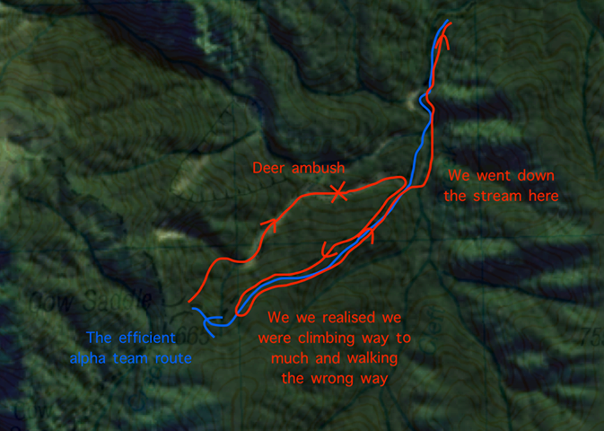
As we drive home we all agree the Blue Range route is the easier option; a much easier track in all respects despite the climb. Later in the day I hear from R, leading the other group leaving via the Ruamahanga. They’ve had an adventure, with higher creeks and streams, hail, cuts, grazes and deer, and had an 8hr day of it. I feel a little guilty we had an easier time of it, but hey – half of us had to.
A+, would car-swap again. Great wee tramp!
Addendum!
Our other group got a bit spun about heading north-west off Cow Saddle, like that other blog did. Seems there’s a track heading more along the stream (north of track) and down, rather than along the ridge and down. So, if you’re reading this and heading up from Cow Creek Hut – from the Cow Saddle 3-way intersection with the track to 1130, down to the hut or to the Ruamahanga – be careful to follow the markers heading east and drop along the ridge, if you want to stay on the ‘marked track’ anyway. Know how long it should be until you reach or follow a proper waterway, and just make sure you’re heading north! Doesn’t really matter if you end up in the creek early as long as you follow the direction of the flow, but it does seem that if you’re heading north on this route, there’re some confusing markers and tracks heading off the saddle.
Leave a Reply